
IMAGES TAKEN NEAR TO
Fosse Row, CHELTENHAM, GL54 2BJ
Introduction
This page details the photographs taken nearby to Fosse Row, GL54 2BJ by members of the Geograph project.
The Geograph project started in 2005 with the aim of publishing, organising and preserving representative images for every square kilometre of Great Britain, Ireland and the Isle of Man.

There are currently over 7.5m images from over14,400 individuals and you can help contribute to the project by visiting https://www.geograph.org.uk
Image Map
Images are licensed for reuse under creativecommons.org/licenses/by-sa/2.0
Notes
- Clicking on the map will re-center to the selected point.
- The higher the marker number, the further away the image location is from the centre of the postcode.
Image Listing (95 Images Found)
Images are licensed for reuse under creativecommons.org/licenses/by-sa/2.0
Image
Details
Distance
1
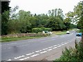
Bourton Bridge
The bridge carries the Fosse Way (A429) over the River Windrush.
Image: © Michael Dibb
Taken: 30 Jul 2010
0.02 miles
2
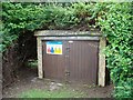
Gauging station
Bourton-on-the-Water's gauging station for the River Windrush is alongside the footpath in Lansdowne Road.
Image: © Michael Dibb
Taken: 30 Jul 2010
0.03 miles
3
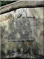
Old Bridge Marker on Borton Bridge
Bridge Marker on the outer side of the parapet of Bourton Bridge, River Windrush, on the southeast side of the A429. On the boundary of Bourton-on-the-Water, Lower Slaughter and Cold Aston parishes. Inscribed with a capricorn, then THE FOSSE WAY HAS PASSED HERE / SINCE ROMAN TIMES HERE IS BURUHFORD OF SALMONSBURY / 8TH CENTURY A.D. / THIS BRIDGE WAS BUILT IN 1806 / AND WIDENED IN 1959 BY THE / GLOUCESTERSHIRE COUNTY COUNCIL. For details of the plaque, read https://www2.glos.ac.uk/bgas/tbgas/v080/bg080173.pdf. Grade II Listed details https://historicengland.org.uk/listing/the-list/list-entry/1089916.
Milestone Society National ID: GL_BWLSCA01br
Image: © Roadside Relics
Taken: 9 Oct 2023
0.03 miles

5
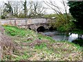
Fosse Bridge
This small stone three arched bridge is tucked in the very north west corner of the grid square and it marks where the River Windrush is bridged by the Fosse Way the A429.
Image: © Nigel Mykura
Taken: 4 Apr 2011
0.03 miles
6
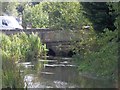
Over the river
Seen from the Windrush Way long distance path, this bridge carries the A429 Fosse Way over the River Windrush near Bourton-on-the-Water.
Image: © Michael Dibb
Taken: 2 Sep 2010
0.04 miles
7
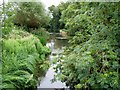
River Windrush
Seen from Bourton Bridge which carries the Fosse Way (A429).
Image: © Michael Dibb
Taken: 30 Jul 2010
0.04 miles
9
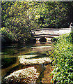
Bridge Over The Windrush
Looking like a scene in some ornamental garden from this angle, this elegant stone bridge is actually carrying the busy Fosse Way over the Windrush.
Image: © Des Blenkinsopp
Taken: 19 Jun 2012
0.04 miles
10
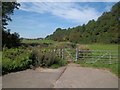
Path leaves the road
The footpath, part of The Windrush Way from Bourton-on-the-Water to Winchcombe, leaves the A429 Fosse Way alongside the river.
Image: © Michael Dibb
Taken: 2 Sep 2010
0.04 miles