
IMAGES TAKEN NEAR TO
Swell Wold, CHELTENHAM, GL54 1HF
Introduction
This page details the photographs taken nearby to Swell Wold, GL54 1HF by members of the Geograph project.
The Geograph project started in 2005 with the aim of publishing, organising and preserving representative images for every square kilometre of Great Britain, Ireland and the Isle of Man.

There are currently over 7.5m images from over14,400 individuals and you can help contribute to the project by visiting https://www.geograph.org.uk
Image Map
Images are licensed for reuse under creativecommons.org/licenses/by-sa/2.0
Notes
- Clicking on the map will re-center to the selected point.
- The higher the marker number, the further away the image location is from the centre of the postcode.
Image Listing (19 Images Found)
Images are licensed for reuse under creativecommons.org/licenses/by-sa/2.0
Image
Details
Distance
1
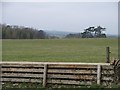
Swell Wold Cottages
The cottages are just visible, across the field, from the minor road. Note the wall has been lower and clad in wood to allow easy access for the local hunt.
Image: © Michael Dibb
Taken: 15 Apr 2010
0.02 miles
2
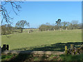
Field with fenced planted trees
In the foreground is a horse jump inserted into a stone wall.
Image: © Robin Webster
Taken: 6 Apr 2015
0.07 miles
3
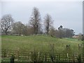
Burial mound
This large burial mound is seen from the minor road. This tumulus is on the lower slopes of Chalk Hill, the higher slopes of which has a number of tumuli. Swell Wold Farm in the right background.
Image: © Michael Dibb
Taken: 15 Apr 2010
0.12 miles
4

Poppy field
Sheep grazing in a dazzling field of poppies to the west of Lower Swell.
Image: © Philip Halling
Taken: 15 Jul 2012
0.15 miles
5

Field of poppies
A dazzling display of poppies in a grassland field to the west of Lower Swell.
Image: © Philip Halling
Taken: 15 Jul 2012
0.15 miles
6
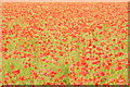
A sea of poppies
A field of poppies in field of pasture to the west of Lower Swell. Presumably the field has been ploughed in the past which has brought the poppy seeds near the surface.
Image: © Philip Halling
Taken: 15 Jul 2012
0.15 miles
7

Field of poppies
Close up of poppies in a field to the west of Lower Swell.
Image: © Philip Halling
Taken: 15 Jul 2012
0.18 miles
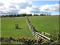
9
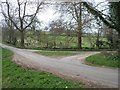
Minor road junction
The road running across the image is signposted left to Guiting Power and Andoversford, right to Lower Swell and Stow-on-the-Wold. The road joining is signposted to Condicote and Tewkesbury.
Image: © Michael Dibb
Taken: 15 Apr 2010
0.18 miles
10
![Roadside barn [1]](https://s3.geograph.org.uk/geophotos/01/82/54/1825451_70452d1d_120x120.jpg)
Roadside barn [1]
This large, well maintained barn is alongside the minor road at the junction of the road to Condicote.
Image: © Michael Dibb
Taken: 15 Apr 2010
0.18 miles