
IMAGES TAKEN NEAR TO
Beechwood Park, CHELTENHAM, GL54 1FR
Introduction
This page details the photographs taken nearby to Beechwood Park, GL54 1FR by members of the Geograph project.
The Geograph project started in 2005 with the aim of publishing, organising and preserving representative images for every square kilometre of Great Britain, Ireland and the Isle of Man.

There are currently over 7.5m images from over14,400 individuals and you can help contribute to the project by visiting https://www.geograph.org.uk
Image Map
Images are licensed for reuse under creativecommons.org/licenses/by-sa/2.0
Notes
- Clicking on the map will re-center to the selected point.
- The higher the marker number, the further away the image location is from the centre of the postcode.
Image Listing (121 Images Found)
Images are licensed for reuse under creativecommons.org/licenses/by-sa/2.0
Image
Details
Distance
1
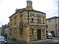
Brewery House
This unusual building was the offices for Stow brewery. Although largely constructed from the local Cotswold Stone characteristic of the area side is unusual in being decorated with flint. Flint as a traditional building material is more usually associated with chalky areas to the south and east of the country.
Image: © David Stowell
Taken: 20 Oct 2006
0.13 miles
2
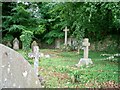
Stow Cemetery
Seen from the Fosse Way is this overgrown corner of the cemetery.
Image: © Michael Dibb
Taken: 15 Jun 2010
0.14 miles
3
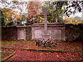
Distinctive grave in Stow-on-the-Wold Cemetery
At the southern edge of the town cemetery.
Image: © Jaggery
Taken: 18 Sep 2018
0.14 miles
5
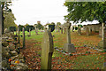
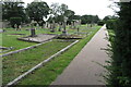
Stow-on-the-Wold Cemetery
A far corner of the cemetery, with the tower of St Edward's Church on the skyline.
Image: © Bill Boaden
Taken: 20 Oct 2017
0.15 miles
6
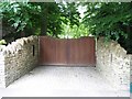
Driveway to Bretton House
Some nice large 'keep the peasants out' gates. Seen from the Fosse Way.
Image: © Michael Dibb
Taken: 15 Jun 2010
0.15 miles
7
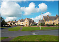
Lower Park Street
Recent housing to the south of the old town centre.
Image: © Des Blenkinsopp
Taken: 21 Jul 2012
0.15 miles
8
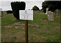
Welcome to Stow-on-the-Wold Cemetery
The notice near the cemetery entrance from the A429 states that the cemetery is owned and maintained by Stow-on-the-Wold Town Council. Keep dogs on a lead - no fouling. Any person causing damage or nuisance will be prosecuted.
Image: © Jaggery
Taken: 18 Sep 2018
0.16 miles
9
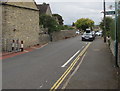
Gloucestershire Way Public Footpath direction sign, Back Walls, Stow-on-the-Wold
The sign on a lamppost points towards this https://www.geograph.org.uk/photo/5913427 path to Sheep Street.
Image: © Jaggery
Taken: 18 Sep 2018
0.17 miles
10
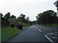
A429 nears the Stow on the Wold boundary
Image: © Colin Pyle
Taken: 13 Aug 2012
0.17 miles