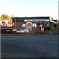
1
Path down to the Frome valley
One way of getting to Stroud, the centre of which is just off to the left.
Image: © Bill Boaden
Taken: 22 Jul 2016
0.07 miles
2
Cows across the path
They were making the most of the shade on this hot day.
Image: © Bill Boaden
Taken: 22 Jul 2016
0.11 miles
3
Playing fields below Rodborough Hill
The field is in a residential area on a hillside well above Stroud.
Image: © Bill Boaden
Taken: 22 Jul 2016
0.14 miles
4
New Thames & Severn Canal bridge under Dr Newton's Way
The original proposals for a new bypass for Stroud would have wiped out the entire route of the canal from here to Wallbridge and made restoration practically impossible. After a very vigorous and effective campaign by the then Stroudwater, Thames & Severn Canal Trust the plans were eventually overturned and an alternative route which only used a short part of the canal route was used. In addition the new bridge seen in the picture, the first new bridge to be built over the canal since 1933, was incorporated into the new road to allow navigation to be restored. A short length of new canal will need to be threaded through the valley beyond here however this is already incorporated in the current restoration plans.
Image: © David Stowell
Taken: 9 Jan 2008
0.14 miles
5
Stroud from the slopes of Rodborough Hill
The steep hill on the south side of Stroud provides a good view of the town. These lower slopes consist of enclosed pasture, with open common land further up.
Image: © David Gruar
Taken: 20 Aug 2006
0.15 miles
6
Large old stone building, near to Stroud Station
The old stone building contrasts with the more recent housing development behind it, rising up the hill from Stroud Station.
Image: © Tom Jolliffe
Taken: 12 Mar 2007
0.15 miles
7
Jewson, Stroud
Jewson is a UK chain of builders merchants. This one is alongside the A419 Dr Newton's Way, Stroud.
Image: © Jaggery
Taken: 6 Sep 2015
0.18 miles
8
Fromeside, Stroud
An industrial estate on a narrow strip of land between the River Frome and the Thames & Severn Canal.
Image: © Christine Johnstone
Taken: 28 Mar 2016
0.18 miles
9
Calor gas cylinders and pump, Stroud
Outside John Stayte Services. http://www.geograph.org.uk/photo/3550117
A brand of bottled butane and propane (liquefied petroleum gas),
Calor Gas is mostly used in rural areas with no mains natural gas supply.
Image: © Jaggery
Taken: 6 Sep 2015
0.19 miles
10
John Stayte Services, Stroud
On the corner of the A419 Dr Newton's Way and Fromeside. The business has an interesting combination of specialities - gas (including AutoGas, Calor Gas & gas spares) and pet food & accessories.
Image: © Jaggery
Taken: 15 Jan 2012
0.19 miles


