
IMAGES TAKEN NEAR TO
/Hill View, CHELTENHAM, GL53 9PB
Introduction
This page details the photographs taken nearby to /Hill View, GL53 9PB by members of the Geograph project.
The Geograph project started in 2005 with the aim of publishing, organising and preserving representative images for every square kilometre of Great Britain, Ireland and the Isle of Man.

There are currently over 7.5m images from over14,400 individuals and you can help contribute to the project by visiting https://www.geograph.org.uk
Image Map
Images are licensed for reuse under creativecommons.org/licenses/by-sa/2.0
Notes
- Clicking on the map will re-center to the selected point.
- The higher the marker number, the further away the image location is from the centre of the postcode.
Image Listing (90 Images Found)
Images are licensed for reuse under creativecommons.org/licenses/by-sa/2.0
Image
Details
Distance
1

Spring, Elkstone
A small spring at the roadside. There is another about 10m away down the slope, which perhaps is fed from this one. They are still in water despite a long period of drought. Situated at a junction of lanes they were perhaps an important local water source at one time.
Image: © Paul Collins
Taken: 13 Jul 2025
0.03 miles
2

Postbox, Elkstone
Situated next to the village hall. This arguably is the beating heart of the village today.
Image: © Paul Collins
Taken: 13 Jul 2025
0.03 miles
3
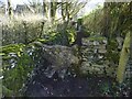
Stone Stile, Elkstone
On Gloucestershire footpath BEL11 adjacent to "Eleysian House" looking from the field, the view looking North is Image
Image: © Mr Red
Taken: 24 Feb 2022
0.03 miles
4
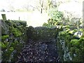
Stone Stile, Elkstone
On Gloucestershire footpath BEL11 adjacent to "Eleysian House" looking North to a field, the view from the field is Image
Image: © Mr Red
Taken: 24 Feb 2022
0.03 miles
5
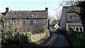
Elkstone village
Two houses end-on to the lane through Elkstone, a memorable signature framing the gable end of the village hall. Hill View opens out just beyond the cottage on the left.
Image: © Chris Brown
Taken: 11 Jan 2017
0.03 miles
6
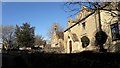
Elkstone village
The former school, with the bellcote, is now the village hall. The house to its right was probably for the master or mistress.
Image: © Chris Brown
Taken: 11 Jan 2017
0.04 miles
7

Cut OS Benchmark, The Village Hall, Elkstone
This benchmark is shown on the 1974 OS 1/2500 map, with a height of 260.07m. The levelling date is 1953 so that is probably when it was carved - it is not shown on earlier editions.
Image: © Paul Collins
Taken: 13 Jul 2025
0.04 miles
8

Green Lane, Elkstone
This green lane is a peaceful road to nowhere. Perhaps it was created as access to an area of pasture in days gone by.
Image: © Paul Collins
Taken: 13 Jul 2025
0.04 miles
9
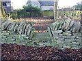
Stone Stile, Elkstone
Looking South into a private wood off the restricted byway BEL12. The view looking back is Image
Image: © Mr Red
Taken: 24 Feb 2022
0.04 miles
10
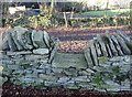
Stone Stile, Elkstone
Looking North from a private wood to the restricted byway BEL12. The view looking in is Image
Image: © Mr Red
Taken: 24 Feb 2022
0.04 miles