
IMAGES TAKEN NEAR TO
Westbury Road, CHELTENHAM, GL53 9EW
Introduction
This page details the photographs taken nearby to Westbury Road, GL53 9EW by members of the Geograph project.
The Geograph project started in 2005 with the aim of publishing, organising and preserving representative images for every square kilometre of Great Britain, Ireland and the Isle of Man.

There are currently over 7.5m images from over14,400 individuals and you can help contribute to the project by visiting https://www.geograph.org.uk
Image Map
Images are licensed for reuse under creativecommons.org/licenses/by-sa/2.0
Notes
- Clicking on the map will re-center to the selected point.
- The higher the marker number, the further away the image location is from the centre of the postcode.
Image Listing (60 Images Found)
Images are licensed for reuse under creativecommons.org/licenses/by-sa/2.0
Image
Details
Distance
1
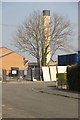
Delancey Hospital Chimney
The hospital has been closed in recent years and is now being redeveloped,
Image: © Terry Jacombs
Taken: 23 Mar 2012
0.05 miles
2
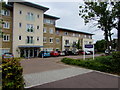
Middleton House, Pilley Lane, Leckhampton, Cheltenham
Set back from the south side of Pilley Lane, Middleton House is modern retirement
housing containing 49 one- and two-bedroom flats for rent or shared ownership.
Image: © Jaggery
Taken: 16 Sep 2018
0.05 miles
3
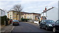
Pilley Lane, Cheltenham
Up ahead is Middleton House, a newly-completed 49-flat sheltered/care home for elderly.
Image: © Jonathan Billinger
Taken: 20 Jan 2015
0.07 miles
4
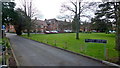
Former Delancey Hospital, Charlton Lane
This complex is now a mixture of retirement and care homes for the elderly.
Image: © Jonathan Billinger
Taken: 20 Jan 2015
0.07 miles
5
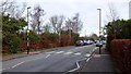
Charlton Lane, Cheltenham, 1
Unimproved 'zebra' crossing.
Image: © Jonathan Billinger
Taken: 20 Jan 2015
0.09 miles
6
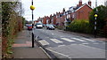
Charlton Lane, Cheltenham, 2
Unimproved 'zebra' crossing and red-brick early 20th century houses.
Image: © Jonathan Billinger
Taken: 20 Jan 2015
0.09 miles
7
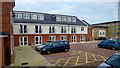
The Grange Care Centre, Pilley Lane
Recently-built facility on part of the site of the old Delancey Hospital.
Image: © Jonathan Billinger
Taken: 20 Jan 2015
0.09 miles
8
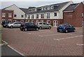
The Grange Care Centre, Leckhampton, Cheltenham
Set back from the north side of Pilley Lane.
Image: © Jaggery
Taken: 16 Sep 2018
0.09 miles
9
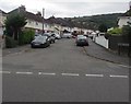
Northeast part of Pilley Crescent, Leckhampton, Cheltenham
Viewed across one of two junctions of Pilley Lane and Pilley Crescent.
The other one is 100 metres to the west. https://www.geograph.org.uk/photo/5907790
Image: © Jaggery
Taken: 16 Sep 2018
0.09 miles
10
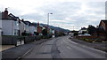
The Old Bath Road, Pilley, Cheltenham
The final section of relatively flat land before the road ascends the Cotswold scarp at Leckhampton Hill.
Image: © Jonathan Billinger
Taken: 20 Jan 2015
0.10 miles