
IMAGES TAKEN NEAR TO
Old Bath Road, CHELTENHAM, GL53 9AF
Introduction
This page details the photographs taken nearby to Old Bath Road, GL53 9AF by members of the Geograph project.
The Geograph project started in 2005 with the aim of publishing, organising and preserving representative images for every square kilometre of Great Britain, Ireland and the Isle of Man.

There are currently over 7.5m images from over14,400 individuals and you can help contribute to the project by visiting https://www.geograph.org.uk
Image Map
Images are licensed for reuse under creativecommons.org/licenses/by-sa/2.0
Notes
- Clicking on the map will re-center to the selected point.
- The higher the marker number, the further away the image location is from the centre of the postcode.
Image Listing (32 Images Found)
Images are licensed for reuse under creativecommons.org/licenses/by-sa/2.0
Image
Details
Distance
1

Pilford Road, Pilley
A variety of house styles are evident here on this cul-de-sac leading off Old Bath Road.
Image: © Stephen McKay
Taken: 1 Apr 2025
0.05 miles
2
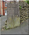
Old Boundary Marker
Municipal Boundary Marker on the southeast side of the junction of Leckhampton Road and Old Bath Road. On the boundary between Cheltenham Borough and Leckhampton parish, Gloucestershire. Inscribed CHELTENHAM │ G C C (both vertical) on its centre face, with B OF C / 1935 above.
Milestone Society National ID: GL_LECCHE02pb
Image: © Mr Red
Taken: 13 Mar 2019
0.05 miles
3

Caution Adders live here
Cheltenham Borough Council has seen fit to warn people entering Charlton Kings Common from Pilford Road that they may encounter adders. As Britain's only venomous snake species, adders attract more than their fair share of fear but in reality they are very unlikely to harm an adult. Even so, it would be wise to keep dogs and small children under supervision.
Image: © Stephen McKay
Taken: 1 Apr 2025
0.07 miles
4
![Small sub-station [1]](https://s1.geograph.org.uk/geophotos/02/69/81/2698193_72a151e5_120x120.jpg)
Small sub-station [1]
This small electrical sub-station is alongside the footpath.
Image: © Michael Dibb
Taken: 23 Jul 2011
0.08 miles
5
![Small sub-station [2]](https://s0.geograph.org.uk/geophotos/02/69/82/2698204_336853f4_120x120.jpg)
Small sub-station [2]
This small electrical sub-station is alongside the footpath.
Image: © Michael Dibb
Taken: 23 Jul 2011
0.08 miles
6
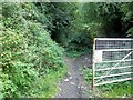
End of the path
The footpath down Leckhampton Hill effectively ends here where it meets the driveway to the village hall.
Image: © Michael Dibb
Taken: 23 Jul 2011
0.08 miles
7

Leckhampton Road
Leckhampton Road drops down into Leckhampton where Undercliff Avenue and then Old Bath Road lead off to the right.
Image: © Stephen McKay
Taken: 1 Apr 2025
0.08 miles
8
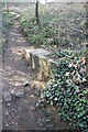
Block on the path
This concrete block jutting out into the path is part of the construction on the small reservoir in the west side of lower Leckhampton Hill.
Image: © Terry Jacombs
Taken: 23 Mar 2012
0.09 miles
9
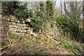
Crumbling Wall
The wall is part of the boundary of the small reservoir on the west side of Leckhampton Hill. Hopefully the actual reservoir is in a better state of maintenance.
Image: © Terry Jacombs
Taken: 23 Mar 2012
0.09 miles
10
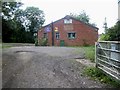
Village Hall
The hall accommodates the local scouts and doubtless other groups in addition. Seen from the footpath.
Image: © Michael Dibb
Taken: 23 Jul 2011
0.09 miles