
IMAGES TAKEN NEAR TO
Copt Elm Road, CHELTENHAM, GL53 8AN
Introduction
This page details the photographs taken nearby to Copt Elm Road, GL53 8AN by members of the Geograph project.
The Geograph project started in 2005 with the aim of publishing, organising and preserving representative images for every square kilometre of Great Britain, Ireland and the Isle of Man.

There are currently over 7.5m images from over14,400 individuals and you can help contribute to the project by visiting https://www.geograph.org.uk
Image Map
Images are licensed for reuse under creativecommons.org/licenses/by-sa/2.0
Notes
- Clicking on the map will re-center to the selected point.
- The higher the marker number, the further away the image location is from the centre of the postcode.
Image Listing (106 Images Found)
Images are licensed for reuse under creativecommons.org/licenses/by-sa/2.0
Image
Details
Distance
1
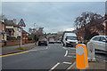
Cheltenham : Copt Elm Road
Looking along Copt Elm Road.
Image: © Lewis Clarke
Taken: 18 Mar 2019
0.03 miles
3
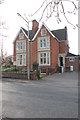
Pinehurst, Lyfield Road West
Two early 20th century villas have been combined to be used as a residential nursing home.
Image: © Terry Jacombs
Taken: 22 Mar 2012
0.05 miles
4
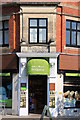
Former Gloucestershire Co-operative Society store
Originally Branch 15 of the Gloucestershire Co-operative Society opened in 1901, it became the well respected local store (Smith & Mann) in the latter part of the last century and is now part of the Budgens group, which is itself I understand a sort of co-operative organisation.
Image: © Terry Jacombs
Taken: 23 May 2012
0.05 miles
5
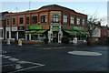
Budgens, Charlton Kings
Budgens store in Charlton Kings.
Image: © Philip Halling
Taken: 5 Dec 2010
0.05 miles
6

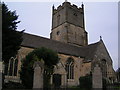
St Mary's Church, Charlton Kings
The church's history goes back over 800 years and it stands in the centre of the old village of Charlton Kings, nowadays a south eastern suburb of Cheltenham.
Image: © Terry Jacombs
Taken: 4 Aug 2005
0.05 miles
7
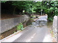
School Road Ford, Charlton Kings
The River Chelt flowing from the north east is joined by a minor stream coming down from Timbercombe/Wistley here. A car was washed away in a flash flood here in the 1990s. It less than 200 metres from the busy A40.
Image: © Terry Jacombs
Taken: 4 Aug 2005
0.05 miles
8
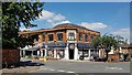
Smith and Mann Grocery Store, Charlton Kings
Image: © Helen Iwanczuk
Taken: 20 Jun 2022
0.05 miles
9
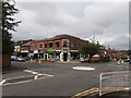
Shops at the corner of Copt Elm Rd and Lyefield Rd West, Charlton Kings
Image: © John Lord
Taken: 26 Aug 2014
0.05 miles
10
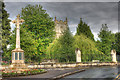
War memorial and St Mary's Church, Charlton Kings
Image: © Glenn burns
Taken: 11 Jun 2011
0.05 miles