IMAGES TAKEN NEAR TO
College Road, CHELTENHAM, GL53 7HY
Introduction
This page details the photographs taken nearby to College Road, GL53 7HY by members of the Geograph project.
The Geograph project started in 2005 with the aim of publishing, organising and preserving representative images for every square kilometre of Great Britain, Ireland and the Isle of Man.

There are currently over 7.5m images from over14,400 individuals and you can help contribute to the project by visiting https://www.geograph.org.uk
Image Map
Images are licensed for reuse under creativecommons.org/licenses/by-sa/2.0
Notes
- Clicking on the map will re-center to the selected point.
- The higher the marker number, the further away the image location is from the centre of the postcode.
Image Listing (389 Images Found)
Images are licensed for reuse under creativecommons.org/licenses/by-sa/2.0
Image
Details
Distance
1
![Cheltenham houses [61]](https://s2.geograph.org.uk/geophotos/06/43/86/6438606_05dd85dd_120x120.jpg)
Cheltenham houses [61]
This fine pair of semi-detached houses are numbers 18 and 20 College Road. An interesting set back design.
Cheltenham is located at the foot of the Cotswold scarp with the small River Chelt flowing through the town. After the discovery of mineral springs in 1716 Cheltenham became a spa town and many Regency houses and other buildings were erected. The town is home to the renowned Cheltenham Festival, four days of horse jump racing culminating in the Gold Cup, held annually in March at the nearby racecourse.
Image: © Michael Dibb
Taken: 12 Mar 2020
0.02 miles
2
![Cheltenham houses [60]](https://s1.geograph.org.uk/geophotos/06/43/86/6438605_1dedd61d_120x120.jpg)
Cheltenham houses [60]
This fine pair of semi-detached houses are numbers 12 and 14 College Road.
Cheltenham is located at the foot of the Cotswold scarp with the small River Chelt flowing through the town. After the discovery of mineral springs in 1716 Cheltenham became a spa town and many Regency houses and other buildings were erected. The town is home to the renowned Cheltenham Festival, four days of horse jump racing culminating in the Gold Cup, held annually in March at the nearby racecourse.
Image: © Michael Dibb
Taken: 12 Mar 2020
0.03 miles
3
![Cheltenham houses [59]](https://s0.geograph.org.uk/geophotos/06/43/86/6438604_b7d3aedb_120x120.jpg)
Cheltenham houses [59]
This fine pair of semi-detached houses are numbers 8 and 10 College Road.
Cheltenham is located at the foot of the Cotswold scarp with the small River Chelt flowing through the town. After the discovery of mineral springs in 1716 Cheltenham became a spa town and many Regency houses and other buildings were erected. The town is home to the renowned Cheltenham Festival, four days of horse jump racing culminating in the Gold Cup, held annually in March at the nearby racecourse.
Image: © Michael Dibb
Taken: 12 Mar 2020
0.03 miles
4
![Cheltenham houses [58]](https://s3.geograph.org.uk/geophotos/06/43/86/6438603_5162441a_120x120.jpg)
Cheltenham houses [58]
This fine pair of semi-detached houses are numbers 4 and 6 College Road.
Cheltenham is located at the foot of the Cotswold scarp with the small River Chelt flowing through the town. After the discovery of mineral springs in 1716 Cheltenham became a spa town and many Regency houses and other buildings were erected. The town is home to the renowned Cheltenham Festival, four days of horse jump racing culminating in the Gold Cup, held annually in March at the nearby racecourse.
Image: © Michael Dibb
Taken: 12 Mar 2020
0.03 miles
5
![Cheltenham houses [63]](https://s0.geograph.org.uk/geophotos/06/43/86/6438608_31de1e13_120x120.jpg)
Cheltenham houses [63]
This house is the end house in a terrace in St Luke's Road with the entrance in the gable end facing the road is number 21 College Road.
Cheltenham is located at the foot of the Cotswold scarp with the small River Chelt flowing through the town. After the discovery of mineral springs in 1716 Cheltenham became a spa town and many Regency houses and other buildings were erected. The town is home to the renowned Cheltenham Festival, four days of horse jump racing culminating in the Gold Cup, held annually in March at the nearby racecourse.
Image: © Michael Dibb
Taken: 12 Mar 2020
0.04 miles
6
![Cheltenham houses [62]](https://s3.geograph.org.uk/geophotos/06/43/86/6438607_76b969b0_120x120.jpg)
Cheltenham houses [62]
This fine pair of semi-detached houses are numbers 22 and 24 College Road. An interesting set back design.
Cheltenham is located at the foot of the Cotswold scarp with the small River Chelt flowing through the town. After the discovery of mineral springs in 1716 Cheltenham became a spa town and many Regency houses and other buildings were erected. The town is home to the renowned Cheltenham Festival, four days of horse jump racing culminating in the Gold Cup, held annually in March at the nearby racecourse.
Image: © Michael Dibb
Taken: 12 Mar 2020
0.04 miles
7
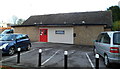
St Luke's Church Hall, Cheltenham
Located in St Luke's Place, north of St Luke's Church. http://www.geograph.org.uk/photo/3496248
Image: © Jaggery
Taken: 25 Nov 2011
0.04 miles
8
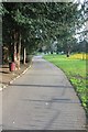
Southern entrance to Sandford Park Ornamental Gardens
Sandford Park has two sections, the ornamental part between Bath Road and College Road and the open play area (with a bit on ornamentation on the eastern side) between College Road and Keynsham Road.
Image: © Terry Jacombs
Taken: 6 Mar 2012
0.04 miles
9
![Sandford Park [6]](https://s3.geograph.org.uk/geophotos/06/43/77/6437755_81fcd280_120x120.jpg)
Sandford Park [6]
A wall at the edge of the park. The plaque indicates that the wall is part of the town's flood defences. The River Chelt caused serious flooding in 1979 and 2007.
Running in a shallow arc from Bath Road to Keynsham Road, Sandford Park was created in 1928 from a former meadow. The recreational part of the park is adjacent to the lido. The ornamental part has a fountain with seating, landscaped beds, cascade pools and the River Chelt. The Annecy Gardens, named after one of Cheltenham's twin towns, are to the north and the Italian Gardens, complete with sunken pool and fountains, lie to the west.
Cheltenham is located at the foot of the Cotswold scarp with the small River Chelt flowing through the town. After the discovery of mineral springs in 1716 Cheltenham became a spa town and many Regency houses and other buildings were erected. The town is home to the renowned Cheltenham Festival, four days of horse jump racing culminating in the Gold Cup, held annually in March at the nearby racecourse.
Image: © Michael Dibb
Taken: 12 Mar 2020
0.04 miles