
IMAGES TAKEN NEAR TO
King Henry Close, CHELTENHAM, GL53 7EZ
Introduction
This page details the photographs taken nearby to King Henry Close, GL53 7EZ by members of the Geograph project.
The Geograph project started in 2005 with the aim of publishing, organising and preserving representative images for every square kilometre of Great Britain, Ireland and the Isle of Man.

There are currently over 7.5m images from over14,400 individuals and you can help contribute to the project by visiting https://www.geograph.org.uk
Image Map
Images are licensed for reuse under creativecommons.org/licenses/by-sa/2.0
Notes
- Clicking on the map will re-center to the selected point.
- The higher the marker number, the further away the image location is from the centre of the postcode.
Image Listing (68 Images Found)
Images are licensed for reuse under creativecommons.org/licenses/by-sa/2.0
Image
Details
Distance
1
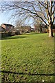
Green Space, Charlton Park Estate
The whole estate was built with several grassy open areas.
Image: © Terry Jacombs
Taken: 6 Mar 2012
0.03 miles
2
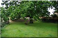
Oak tree and footpath, Charlton Kings, Cheltenham, Glos
A magnificent oak tree just off the Cox's Meadow to Charlton Kings footpath and cycleway. Underneath it there is an unofficial footpath leading up to King Henry Close.
Image: © P L Chadwick
Taken: 13 Jun 2015
0.05 miles
3
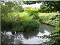
The Balancing Pool, Charlton Park
When the estate was built in the 1970s/1980s, this pool was created to create a buffer for water runoff. It has become home to a thriving colony of ducks.
Image: © Terry Jacombs
Taken: 4 Aug 2005
0.05 miles
4
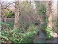
Lilley Brook near Cox's Meadow
The Lilley Brook meanders through trees at the edge of Cox's Meadow just before it joins the River Chelt.
Image: © Terry Jacombs
Taken: 19 Nov 2008
0.05 miles
5
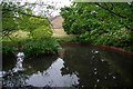
Pond (1), Charlton Kings, Cheltenham, Glos
The pond is adjacent to the footpath and cycleway running between Cox's Meadow and Charlton Kings. See also:- Image
Image: © P L Chadwick
Taken: 13 Jun 2015
0.06 miles
6
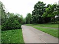
Junction of two footpaths, Cox's Meadow, Cheltenham, Glos
On the edge of the meadow these two footpaths merge. That on the left is also a cycleway to Charlton Kings. The path on the right has come from an adjacent housing estate.
Image
Image: © P L Chadwick
Taken: 22 May 2015
0.06 miles
7
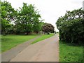
Fork in footpath, Cox's Meadow, Cheltenham, Glos
The footpath on the left goes to an adjacent housing estate. That on the right leads to Old Bath Road and is also part of the cycleway connecting Cheltenham and Charlton Kings.
Image
Image: © P L Chadwick
Taken: 22 May 2015
0.06 miles
8
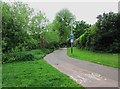
Cycleway and footpath to Charlton Kings, Cheltenham, Glos
The cycleway and footpath has come from Old Bath Road, through Cox's Meadow, and is now heading for Charlton Kings. This is now a suburb of Cheltenham and a civil parish. Until April 1974 it used to be an urban district council.
Image: © P L Chadwick
Taken: 22 May 2015
0.06 miles
9
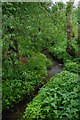
River Chelt (2), Charlton Kings, Cheltenham, Glos
The River Chelt is a tributary of England's largest river, the River Severn.
Image
Image: © P L Chadwick
Taken: 13 Jun 2015
0.06 miles
10
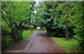
Footpath & cycleway from Cox's Meadow to Charlton Kings, Cheltenham, Glos
In this direction it is heading for Cox's Meadow. The sign on the lamppost indicates that by bicycle it takes six minutes to get to the town centre.
Image: © P L Chadwick
Taken: 13 Jun 2015
0.06 miles