1
The Close, Leckhampton, Cheltenham
From the SE side of Church Road, The Close leads to Griffin Lane, Thompson Drive, Giffard Way.
Image: © Jaggery
Taken: 16 Sep 2018
0.03 miles
2
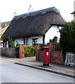
Queen Elizabeth II pillarbox, Church Road, Leckhampton, Cheltenham
Near Grade II listed Norwood Cottages. https://www.geograph.org.uk/photo/5920786
Image: © Jaggery
Taken: 16 Sep 2018
0.05 miles
3
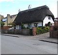
Grade II listed Norwood Cottages, Church Road, Leckhampton, Cheltenham
Pair of thatched roof cottages at 58 and 60 Church Road dating from c1600.
Image: © Jaggery
Taken: 16 Sep 2018
0.05 miles
4
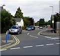
Footpath crosses road [2]
The footpath has descended Leckhampton Hill, crossed Collum End Rise and now makes its way to its starting point at The Close.
Image: © Michael Dibb
Taken: 23 Jul 2011
0.05 miles
5
Cars and brick houses, Leckhampton, Cheltenham
On the north side of Church Road.
Image: © Jaggery
Taken: 16 Sep 2018
0.07 miles
6
Leckhampton War Memorial, Cheltenham
On the corner of Church Road and Hall Road. The War Memorials Online website records that Leckhampton War Memorial, designed by local architect L.W.Barnard, was made from limestone supplied by the Leckhampton Quarry Company. It was unveiled on Easter Monday 1920 by Sir Ashton Lister, MP for Stroud.
Image: © Jaggery
Taken: 16 Sep 2018
0.08 miles
7
Grade II listed number 78 Church Road, Leckhampton, Cheltenham
The exact year of construction of this thatched cottage with decorative ridge thatching is unknown.
It is likely to date from the late 16th to mid 17th century.
Image: © Jaggery
Taken: 16 Sep 2018
0.08 miles
8
Footpath crosses road [1]
A footpath that runs from The Close here crosses Collum End Rise as it heads up Leckhampton Hill.
Image: © Michael Dibb
Taken: 23 Jul 2011
0.09 miles
9
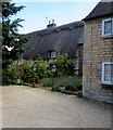
Grade II listed former Collum End Farmhouse, Church Road, Leckhampton, Cheltenham
Now two houses, originally a farmhouse dating from the late 16th
or early 17th century. A 20th century extension is on the right.
Image: © Jaggery
Taken: 16 Sep 2018
0.10 miles
10
Southern end of Hall Road, Leckhampton, Cheltenham
North along Hall Road from Church Road.
Image: © Jaggery
Taken: 16 Sep 2018
0.11 miles


![Footpath crosses road [2]](https://s2.geograph.org.uk/geophotos/02/69/82/2698222_ebd9c460_120x120.jpg)


![Footpath crosses road [1]](https://s2.geograph.org.uk/geophotos/02/69/82/2698218_9d4e3e32_120x120.jpg)

