IMAGES TAKEN NEAR TO
Collum End Rise, CHELTENHAM, GL53 0PB
Introduction
This page details the photographs taken nearby to Collum End Rise, GL53 0PB by members of the Geograph project.
The Geograph project started in 2005 with the aim of publishing, organising and preserving representative images for every square kilometre of Great Britain, Ireland and the Isle of Man.

There are currently over 7.5m images from over14,400 individuals and you can help contribute to the project by visiting https://www.geograph.org.uk
Image Map
Images are licensed for reuse under creativecommons.org/licenses/by-sa/2.0
Notes
- Clicking on the map will re-center to the selected point.
- The higher the marker number, the further away the image location is from the centre of the postcode.
Image Listing (75 Images Found)
Images are licensed for reuse under creativecommons.org/licenses/by-sa/2.0
Image
Details
Distance
1
![Footpath crosses road [2]](https://s2.geograph.org.uk/geophotos/02/69/82/2698222_ebd9c460_120x120.jpg)
Footpath crosses road [2]
The footpath has descended Leckhampton Hill, crossed Collum End Rise and now makes its way to its starting point at The Close.
Image: © Michael Dibb
Taken: 23 Jul 2011
0.02 miles
2
![Footpath crosses road [1]](https://s2.geograph.org.uk/geophotos/02/69/82/2698218_9d4e3e32_120x120.jpg)
Footpath crosses road [1]
A footpath that runs from The Close here crosses Collum End Rise as it heads up Leckhampton Hill.
Image: © Michael Dibb
Taken: 23 Jul 2011
0.03 miles
3
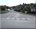
The Close, Leckhampton, Cheltenham
From the SE side of Church Road, The Close leads to Griffin Lane, Thompson Drive, Giffard Way.
Image: © Jaggery
Taken: 16 Sep 2018
0.08 miles
4
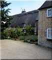
Grade II listed number 78 Church Road, Leckhampton, Cheltenham
The exact year of construction of this thatched cottage with decorative ridge thatching is unknown.
It is likely to date from the late 16th to mid 17th century.
Image: © Jaggery
Taken: 16 Sep 2018
0.10 miles
5
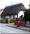
Queen Elizabeth II pillarbox, Church Road, Leckhampton, Cheltenham
Near Grade II listed Norwood Cottages. https://www.geograph.org.uk/photo/5920786
Image: © Jaggery
Taken: 16 Sep 2018
0.11 miles
6
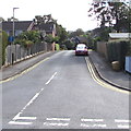
Collum End Rise, Leckhampton, Cheltenham
On the left, a No Through Road sign faces Church Road.
Image: © Jaggery
Taken: 16 Sep 2018
0.11 miles
7
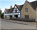
Grade II listed former Collum End Farmhouse, Church Road, Leckhampton, Cheltenham
Now two houses, originally a farmhouse dating from the late 16th
or early 17th century. A 20th century extension is on the right.
Image: © Jaggery
Taken: 16 Sep 2018
0.11 miles
8
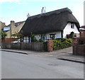
Grade II listed Norwood Cottages, Church Road, Leckhampton, Cheltenham
Pair of thatched roof cottages at 58 and 60 Church Road dating from c1600.
Image: © Jaggery
Taken: 16 Sep 2018
0.11 miles
9
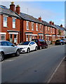
Cars and brick houses, Leckhampton, Cheltenham
On the north side of Church Road.
Image: © Jaggery
Taken: 16 Sep 2018
0.11 miles