
IMAGES TAKEN NEAR TO
Kidnappers Lane, CHELTENHAM, GL53 0NP
Introduction
This page details the photographs taken nearby to Kidnappers Lane, GL53 0NP by members of the Geograph project.
The Geograph project started in 2005 with the aim of publishing, organising and preserving representative images for every square kilometre of Great Britain, Ireland and the Isle of Man.

There are currently over 7.5m images from over14,400 individuals and you can help contribute to the project by visiting https://www.geograph.org.uk
Image Map
Images are licensed for reuse under creativecommons.org/licenses/by-sa/2.0
Notes
- Clicking on the map will re-center to the selected point.
- The higher the marker number, the further away the image location is from the centre of the postcode.
Image Listing (4 Images Found)
Images are licensed for reuse under creativecommons.org/licenses/by-sa/2.0
Image
Details
Distance
1
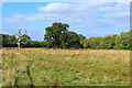
Field in Leckampton
Field footpath off Kidnappers Lane.
Image: © Wayland Smith
Taken: 22 Sep 2021
0.02 miles
2
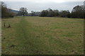
Farmland at Leckhampton
Field on the edge of the suburbs of Cheltenham.
Image: © Philip Halling
Taken: 29 Jan 2011
0.14 miles
3
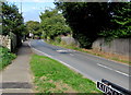
Kidnappers Lane, Leckhampton, Cheltenham
Viewed from the corner of Church Road. The Leckhampton Local History Society website records that the lane was originally Green Lane. The first mention in print of Kidnappers Lane was on the 1884 Ordnance Survey map. In 1896, R.C. Barnard, the great historian of Leckhampton, wrote in his notebook that he could offer no explanation for the name Kidnappers Lane.
Image: © Jaggery
Taken: 16 Sep 2018
0.24 miles
4
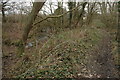
Moat at Leckhampton
This moat at Leckhampton which is passed by a footpath is still substantial.
Image: © Philip Halling
Taken: 29 Jan 2011
0.25 miles