
IMAGES TAKEN NEAR TO
Hall Road, CHELTENHAM, GL53 0HE
Introduction
This page details the photographs taken nearby to Hall Road, GL53 0HE by members of the Geograph project.
The Geograph project started in 2005 with the aim of publishing, organising and preserving representative images for every square kilometre of Great Britain, Ireland and the Isle of Man.

There are currently over 7.5m images from over14,400 individuals and you can help contribute to the project by visiting https://www.geograph.org.uk
Image Map
Images are licensed for reuse under creativecommons.org/licenses/by-sa/2.0
Notes
- Clicking on the map will re-center to the selected point.
- The higher the marker number, the further away the image location is from the centre of the postcode.
Image Listing (43 Images Found)
Images are licensed for reuse under creativecommons.org/licenses/by-sa/2.0
Image
Details
Distance
1
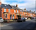
Brick houses, Church Road, Leckhampton, Cheltenham
On the north side of Church Road between Hall Road and Leckhampton Road.
Image: © Jaggery
Taken: 16 Sep 2018
0.08 miles
2
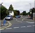
Southern end of Hall Road, Leckhampton, Cheltenham
North along Hall Road from Church Road.
Image: © Jaggery
Taken: 16 Sep 2018
0.09 miles
3
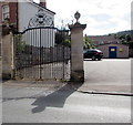
Grade II listed gates and gate piers, Church Road, Leckhampton, Cheltenham
Located on the south side of Church Road a few metres from Leckhampton Village Hall. https://www.geograph.org.uk/photo/5907834
Dated 1901, made by Letheren and Sons of the Vulcan Iron Works, Cheltenham.
Image: © Jaggery
Taken: 16 Sep 2018
0.09 miles
4
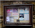
Village Hall Notices, Leckhampton, Cheltenham
On the wall of Leckhampton Village Hall, above the green bin here. https://www.geograph.org.uk/photo/5907834
Image: © Jaggery
Taken: 16 Sep 2018
0.09 miles
5
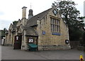
Grade II listed Leckhampton Village Hall, Cheltenham
The hall on the south side of Church Road Leckhampton dates from 1897.
It used to be St Peter's Church Parish Hall.
In 2018 many classes and groups meet here each week.
The hall is also available to hire for parties, meetings and events.
Image: © Jaggery
Taken: 16 Sep 2018
0.09 miles
6
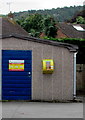
Yellow defibrillator box near Leckhampton Village Hall, Cheltenham
Set back from the south side of Church Road, in the background here. https://www.geograph.org.uk/photo/5907855 The yellow box contains a defibrillator for use in a potentially life-threatening emergency. The defibrillator applies a therapeutic electric current to the chest or heart to stop irregular contractions, or fibrillation, of the heart. Instructions for use are on the blue door.
Image: © Jaggery
Taken: 16 Sep 2018
0.10 miles
7
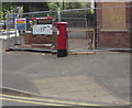
Fenced-off building site on a Leckhampton corner, Cheltenham
On the corner of Church Road and Leckhampton Road viewed in September 2018.
An August 2016 Google Earth Street View shows Leckhampton Convenience Store here.
Earlier, this corner was the location of Leckhampton Post Office which closed down c2000.
The pillarbox is Edwardian. https://www.geograph.org.uk/photo/5907942
Image: © Jaggery
Taken: 16 Sep 2018
0.11 miles
8
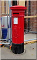
King Edward VII pillarbox on a Leckhampton corner, Cheltenham
Located here https://www.geograph.org.uk/photo/5907940 on the corner of Church Road and Leckhampton Road.
Image: © Jaggery
Taken: 16 Sep 2018
0.11 miles
9
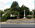
Leckhampton War Memorial, Cheltenham
On the corner of Church Road and Hall Road. The War Memorials Online website records that Leckhampton War Memorial, designed by local architect L.W.Barnard, was made from limestone supplied by the Leckhampton Quarry Company. It was unveiled on Easter Monday 1920 by Sir Ashton Lister, MP for Stroud.
Image: © Jaggery
Taken: 16 Sep 2018
0.12 miles
10
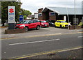
John Wilkins Cars premises, Leckhampton, Cheltenham
At 170-172 Leckhampton Road on the corner of Pilley Lane.
Image: © Jaggery
Taken: 16 Sep 2018
0.15 miles