
IMAGES TAKEN NEAR TO
Tansy Mews, CHELTENHAM, GL53 0FG
Introduction
This page details the photographs taken nearby to Tansy Mews, GL53 0FG by members of the Geograph project.
The Geograph project started in 2005 with the aim of publishing, organising and preserving representative images for every square kilometre of Great Britain, Ireland and the Isle of Man.

There are currently over 7.5m images from over14,400 individuals and you can help contribute to the project by visiting https://www.geograph.org.uk
Image Map
Images are licensed for reuse under creativecommons.org/licenses/by-sa/2.0
Notes
- Clicking on the map will re-center to the selected point.
- The higher the marker number, the further away the image location is from the centre of the postcode.
Image Listing (11 Images Found)
Images are licensed for reuse under creativecommons.org/licenses/by-sa/2.0
Image
Details
Distance
1
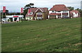
Redrow sales office and new houses, Brizen View, Shurdington near Cheltenham
Redrow's Brizen View housing development at Farm Lane Shurdington viewed in September 2018.
Image: © Jaggery
Taken: 16 Sep 2018
0.08 miles
2
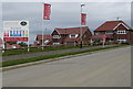
Brizen View access road, Shurdington near Cheltenham
A Redrow housing development at Farm Lane, Shurdington viewed from the corner of Leckhampton Lane in September 2018. Below site safety information on the Redrow board is the statement
No deliveries before 8.00am. Offenders will be fined £200.
Image: © Jaggery
Taken: 16 Sep 2018
0.16 miles
3
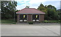
Two new electricity substations near the corner of Leckhampton Lane, Shurdington
Western Power Distribution electricity substations alongside the access road https://www.geograph.org.uk/photo/5908586 to the Brizen View housing development viewed in September 2018. The substation identifiers are The Berries 795858 and Leckhampton La(ne) 795857.
Image: © Jaggery
Taken: 16 Sep 2018
0.18 miles
4
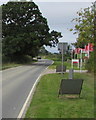
West along Leckhampton Lane, Shurdington
Turn right for the access road https://www.geograph.org.uk/photo/5908586 to Redrow's Brizen View housing development.
Image: © Jaggery
Taken: 16 Sep 2018
0.18 miles
5
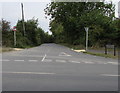
Farm Lane near Leckhampton, Cheltenham
On the north side of crossroads. https://www.geograph.org.uk/photo/5908672
Image: © Jaggery
Taken: 16 Sep 2018
0.20 miles
6
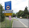
Up Hatherley direction sign on the approach to Leckhampton, Cheltenham
Facing Leckhampton Lane on the approach to crossroads. An inconspicuous small sign shows
SPEED LIMIT 30 MPH - SLOW AND QUIET - THINK OF THE NEIGHBOURS.
Image: © Jaggery
Taken: 16 Sep 2018
0.22 miles
7
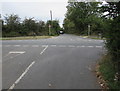
Crossroads on the western approach to Leckhampton, Cheltenham
Viewed from Crippetts Lane. Left for Leckhampton Lane, ahead for Farm Lane,
right for Church Road towards the centre of Leckhampton.
Image: © Jaggery
Taken: 16 Sep 2018
0.23 miles
8
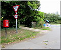
Queen Elizabeth II postbox, Crippetts Lane near Leckhampton, Cheltenham
On the right here. https://www.geograph.org.uk/photo/5908663
Image: © Jaggery
Taken: 16 Sep 2018
0.23 miles
9
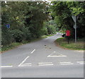
Northern end of Crippetts Lane near Leckhampton, Cheltenham
Viewed from Farm Lane. The sign on the left shows that Crippetts Lane is not a through route.
Image: © Jaggery
Taken: 16 Sep 2018
0.24 miles
10
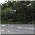
Directions in a Crippetts Lane hedge near Leckhampton, Cheltenham
Left along Church Road for Leckhampton. Right along Leckhampton Lane for Shurdington.
Image: © Jaggery
Taken: 16 Sep 2018
0.24 miles