1
Brimscombe Lane, Brimscombe
Brimscombe Lane ascends northwards away from the A419 London Road.
Image: © Jaggery
Taken: 6 Sep 2015
0.03 miles
2
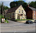
Old Chapel, London Road, Brimscombe
The Old Chapel, now a house, is next door to the Old Telephone Exchange http://www.geograph.org.uk/photo/4648099 just out of shot on the left.
Image: © Jaggery
Taken: 6 Sep 2015
0.06 miles
3
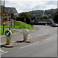
Pedestrian refuge, London Road, Brimscombe
In the middle of the A419 London Road, near the Brimscombe Lane http://www.geograph.org.uk/photo/4648051 junction.
Image: © Jaggery
Taken: 6 Sep 2015
0.06 miles
4
Road signs near Mill Close, Brimscombe
Viewed across the A419 London Road. On the left side of Mill Close, the white P on a blue background indicates a parking area. On the right, a black arrow on a sign showing Burleigh and Minchinhampton points right, on the approach to the London Road/Brimscombe Hill junction.
Image: © Jaggery
Taken: 6 Sep 2015
0.06 miles
5
Junction of Mill Close and London Road, Brimscombe
Viewed across the A419 London Road.
Image: © Jaggery
Taken: 6 Sep 2015
0.06 miles
6
London Road, Brimscombe
Looking NNW along the A419 London Road. The Brimscombe Lane junction is on the right. http://www.geograph.org.uk/photo/4648051
Image: © Jaggery
Taken: 6 Sep 2015
0.06 miles
7
Old Telephone Exchange, Brimscombe
House on the north side of the A419 London Road.
Image: © Jaggery
Taken: 6 Sep 2015
0.06 miles
8
Brimscombe War Memorial
At the top of steps on the north side of the A419 London Road near the Brimscombe Lane junction.
Image: © Jaggery
Taken: 6 Sep 2015
0.06 miles
9
Mill Close
This is a short residential cul de sac with modern three storey detached houses perched just above the main road and looking out over the Frome valley.
Image: © Nigel Mykura
Taken: 7 Oct 2011
0.06 miles
10
The A419 through Brimscombe
Image: © andrew auger
Taken: 3 Jul 2010
0.06 miles


