
IMAGES TAKEN NEAR TO
Rodborough Lane, STROUD, GL5 2LJ
Introduction
This page details the photographs taken nearby to Rodborough Lane, GL5 2LJ by members of the Geograph project.
The Geograph project started in 2005 with the aim of publishing, organising and preserving representative images for every square kilometre of Great Britain, Ireland and the Isle of Man.

There are currently over 7.5m images from over14,400 individuals and you can help contribute to the project by visiting https://www.geograph.org.uk
Image Map
Images are licensed for reuse under creativecommons.org/licenses/by-sa/2.0
Notes
- Clicking on the map will re-center to the selected point.
- The higher the marker number, the further away the image location is from the centre of the postcode.
Image Listing (69 Images Found)
Images are licensed for reuse under creativecommons.org/licenses/by-sa/2.0
Image
Details
Distance
1
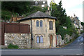
Old Toll House, Butterrow
Toll House in the parish of Rodborough (Stroud District), The Pike, at the junction of Butterrow Hill and Rodborough Lane, GL5 2LH.
Grade II listed.
List Entry Number: 1090711 https://historicengland.org.uk/listing/the-list/list-entry/1090711
Surveyed
Milestone Society National ID: GL.ROD
Image: © Alan Rosevear
Taken: Unknown
0.07 miles
2
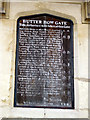
Butter Row Gate tolls
A close-up of the table of tolls formerly charged on this route. Landaus, barouches, marine calashes and droves of hogs are a somewhat rarer sight these days than they evidently were in the 1750s.
Image: © David Gruar
Taken: 22 Oct 2006
0.09 miles
3
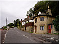
Butter Row Gate toll house
Tollbooth on the turnpike road from Stroud to Cirencester via Minchinhampton, built in the mid-18th century. The road is still used today by drivers wanting to avoid the busier "official" route of the A419, but you can now travel along it for free.
Image: © David Gruar
Taken: 22 Oct 2006
0.09 miles
4
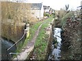
Bowbridge Lock
The River Frome veers off to the left just before Bowbridge Lock. The lock chamber is in a reasonably good condition, if slightly covered by light undergrowth. The top end of the lock and length of the Thames & Severn Canal above here was the first to be tackled by the then Stroudwater Canal Society (the forerunner of today's Cotswold Canal's Trust) when they commenced campaigning for restoration in the 1970s.
Image: © David Stowell
Taken: 30 Jan 2008
0.09 miles
5
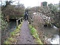
Bowbridge bridge
The River Frome and the Thames & Severn Canal are again side by side and only separated by the canal towpath as they approach the bridges under the road up to Rodborough Common. The road has been widened during the period of the canal's closure and so this side of the bridge has been extended with a culverted embankment.
Image: © David Stowell
Taken: 30 Jan 2008
0.09 miles
6
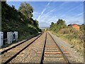
Bowbridge Crossing railway Halt (site), Gloucestershire
Opened in 1905 by the Great Western Railway on the line from Swindon to Gloucester, this station closed in 1964.
View north west towards Stroud and Gloucester, from a foot crossing. No trace appears to remain of the two short parallel platforms here.
Image: © Nigel Thompson
Taken: 9 Oct 2021
0.10 miles
7
The Swindon - Gloucester line at Bowbridge
Image: © Steve Daniels
Taken: 2 Sep 2009
0.11 miles
9
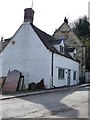
Old houses on Butterrow Hill, Bowbridge
Just west of the Thames & Severn Canal.
Image: © Christine Johnstone
Taken: 28 Mar 2016
0.11 miles
10
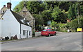
Grade II listed Bridge Cottage, Stroud
18th century cottage viewed across Butterrow Hill.
Image: © Jaggery
Taken: 6 Sep 2015
0.11 miles