
IMAGES TAKEN NEAR TO
Bowbridge Lane, STROUD, GL5 2JL
Introduction
This page details the photographs taken nearby to Bowbridge Lane, GL5 2JL by members of the Geograph project.
The Geograph project started in 2005 with the aim of publishing, organising and preserving representative images for every square kilometre of Great Britain, Ireland and the Isle of Man.

There are currently over 7.5m images from over14,400 individuals and you can help contribute to the project by visiting https://www.geograph.org.uk
Image Map
Images are licensed for reuse under creativecommons.org/licenses/by-sa/2.0
Notes
- Clicking on the map will re-center to the selected point.
- The higher the marker number, the further away the image location is from the centre of the postcode.
Image Listing (64 Images Found)
Images are licensed for reuse under creativecommons.org/licenses/by-sa/2.0
Image
Details
Distance
1
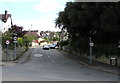
Bowbridge Lane, Stroud
A 20mph speed limit is in force along Bowbridge Lane.
Viewed across the A419 London Road from alongside the British Oak pub. http://www.geograph.org.uk/photo/4648912
Image: © Jaggery
Taken: 6 Sep 2015
0.09 miles
2
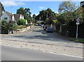
Park Road, Stroud
The SE end of Park Road viewed across the A419 London Road.
Image: © Jaggery
Taken: 6 Sep 2015
0.09 miles
3
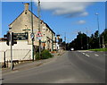
London Road, Bowbridge, Stroud
Viewed from the corner of Butterrow Hill. The A419 London Road passes the British Oak pub. http://www.geograph.org.uk/photo/4648912
Image: © Jaggery
Taken: 6 Sep 2015
0.14 miles
4
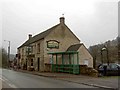
The British Oak public house
On London Road near Thrupp.
Image: © Steve Fareham
Taken: 27 Jan 2009
0.14 miles
5
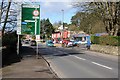
The A419 in the Stroud valley
The A419 in the Stroud valley between Thrupp and Stroud.
Image: © Philip Halling
Taken: 30 Jan 2016
0.14 miles

7
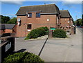
Ashcroft House, Stroud
Located alongside London Road near the Park Road junction, Ashcroft House contains 16 flats, built in 1988. Managed by Stroud District Council, Ashcroft House has a resident management staff and a community alarm service.
Image: © Jaggery
Taken: 6 Sep 2015
0.14 miles
8
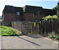
Bowbridge electricity substation, Stroud
The Western Power Distribution electricity substation identifier is 10291 BOWBRIDGE. A caution notice on the wooden fence shows the presence of SF6 ( (sulphur hexafluoride, an insulating gas used in high voltage systems).
The location is alongside London Road in the southeast of Stroud, at the northern edge of Ashcroft House. http://www.geograph.org.uk/photo/4652062
Image: © Jaggery
Taken: 6 Sep 2015
0.14 miles
9
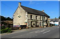
British Oak pub, Bowbridge, Stroud
London Road pub opposite Bowbridge Lane.
Image: © Jaggery
Taken: 6 Sep 2015
0.15 miles
10
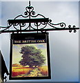
British Oak pub name sign and bracket, Stroud
On the wall here. http://www.geograph.org.uk/photo/4648912
Image: © Jaggery
Taken: 6 Sep 2015
0.15 miles