
IMAGES TAKEN NEAR TO
Foxmoor, CHELTENHAM, GL52 8SS
Introduction
This page details the photographs taken nearby to Foxmoor, GL52 8SS by members of the Geograph project.
The Geograph project started in 2005 with the aim of publishing, organising and preserving representative images for every square kilometre of Great Britain, Ireland and the Isle of Man.

There are currently over 7.5m images from over14,400 individuals and you can help contribute to the project by visiting https://www.geograph.org.uk
Image Map
Images are licensed for reuse under creativecommons.org/licenses/by-sa/2.0
Notes
- Clicking on the map will re-center to the selected point.
- The higher the marker number, the further away the image location is from the centre of the postcode.
Image Listing (5 Images Found)
Images are licensed for reuse under creativecommons.org/licenses/by-sa/2.0
Image
Details
Distance
1
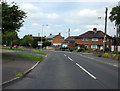
Bishops Drive Junction With Two Hedges Road Bishop's Drive
Image: © Roy Hughes
Taken: 23 May 2015
0.11 miles
2
Approaching Island on Bishop's Cleeve By-Pass
Image: © Roy Hughes
Taken: 29 Nov 2014
0.11 miles
3
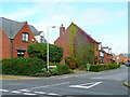
Furlong Lane, Bishop's Cleeve
The village expanded rapidly in the 1980's and 90's to meet demand for folks to work in Cheltenham and Gloucester.
Image: © Jonathan Billinger
Taken: 24 Sep 2009
0.20 miles
4
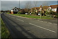
Modern housing at Bishop's Cleeve
In the last twenty years or so Bishop's Cleeve has grown enormously.
Image: © Philip Halling
Taken: 6 Dec 2009
0.20 miles
5
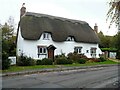
Bishop's Cleeve houses [4]
Willow Cottage, number 1 Stoke Road, was built in the late 17th or early 18th century. Timber framed, probably square-panelled, now pebbledashed set on a limestone plinth under a thatch roof. Listed, grade II, with details at: https://historicengland.org.uk/listing/the-list/list-entry/1154408
Bishop's Cleeve is a large village in Gloucestershire. It lies at the foot of Cleeve Hill, the highest point of the Cotswolds, some 3½ miles north of Cheltenham. Although Iron Age and Roman remains have been found locally, the earliest known origins of the village date to the 8th Century. A monastery and surrounding land was given to the Bishop of Worcester, and the village became the Bishop’s Cliffe. The village grew rapidly when an aerospace factory was built nearby after the Second World War and continues to grow.
Image: © Michael Dibb
Taken: 9 Nov 2021
0.25 miles