
IMAGES TAKEN NEAR TO
Wellbrook Road, CHELTENHAM, GL52 8BW
Introduction
This page details the photographs taken nearby to Wellbrook Road, GL52 8BW by members of the Geograph project.
The Geograph project started in 2005 with the aim of publishing, organising and preserving representative images for every square kilometre of Great Britain, Ireland and the Isle of Man.

There are currently over 7.5m images from over14,400 individuals and you can help contribute to the project by visiting https://www.geograph.org.uk
Image Map
Images are licensed for reuse under creativecommons.org/licenses/by-sa/2.0
Notes
- Clicking on the map will re-center to the selected point.
- The higher the marker number, the further away the image location is from the centre of the postcode.
Image Listing (110 Images Found)
Images are licensed for reuse under creativecommons.org/licenses/by-sa/2.0
Image
Details
Distance
1
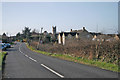
Gotherington Lane, Bishop's Cleeve
Looking south to the start of the village with the church tower in the background
Image: © Paul Makepeace
Taken: 10 Mar 2007
0.11 miles
2
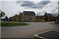
New houses off Gotherington Lane, Bishops Cleeve
Image: © Ian S
Taken: 21 May 2014
0.14 miles
3
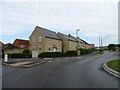
New housing on Gotherington Lane, Bishop's Cleeve
Image: © JThomas
Taken: 13 Aug 2021
0.15 miles
4
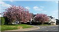
Spring is here.
A very good indication of the arrival of Spring, are the trees at the bottom of Millham Road in Bishop's Cleeve. They look splendid when they are in full blossom.
Image: © Helen Iwanczuk
Taken: 12 Apr 2019
0.16 miles
5
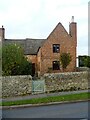
Bishop's Cleeve houses [12]
Number 25 Station Road, seen here, is semi-detached with number 23 Station Road Image Built in the 17th century and altered in the 18th century. Constructed of square-panelled timber framing with rendered infill on a limestone plinth, now largely encased in brick, all under a concrete tile roof. Listed, grade II, with details at: https://historicengland.org.uk/listing/the-list/list-entry/1091699
Bishop's Cleeve is a large village in Gloucestershire. It lies at the foot of Cleeve Hill, the highest point of the Cotswolds, some 3½ miles north of Cheltenham. Although Iron Age and Roman remains have been found locally, the earliest known origins of the village date to the 8th Century. A monastery and surrounding land was given to the Bishop of Worcester, and the village became the Bishop’s Cliffe. The village grew rapidly when an aerospace factory was built nearby after the Second World War and continues to grow.
Image: © Michael Dibb
Taken: 9 Nov 2021
0.16 miles
6
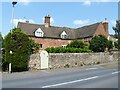
Bishop's Cleeve houses [11]
Number 23 Station Road, seen here, is semi-detached with number 25 Station Road Image Built, possibly, in the 16th century the existence of a limestone plinth indicates that the house was probably timber framed and later encased or rebuilt in brick. The left gable end is constructed of squared, coursed limestone. The roof is of concrete tile. Listed, grade II, with details at: https://historicengland.org.uk/listing/the-list/list-entry/1340175
Bishop's Cleeve is a large village in Gloucestershire. It lies at the foot of Cleeve Hill, the highest point of the Cotswolds, some 3½ miles north of Cheltenham. Although Iron Age and Roman remains have been found locally, the earliest known origins of the village date to the 8th Century. A monastery and surrounding land was given to the Bishop of Worcester, and the village became the Bishop’s Cliffe. The village grew rapidly when an aerospace factory was built nearby after the Second World War and continues to grow.
Image: © Michael Dibb
Taken: 21 Jul 2021
0.16 miles
8
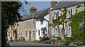
Cottages, Station Road, Bishops Cleeve
Old cottages near the church
Image: © John Matthews
Taken: 21 Apr 2008
0.17 miles
9
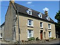
Bishop's Cleeve houses [14]
The Old Manor House, number 43 Station Road, was, probably, built in the 18th century. Constructed of coursed rubble stone with freestone quoins and dressings under a tile roof.
Bishop's Cleeve is a large village in Gloucestershire. It lies at the foot of Cleeve Hill, the highest point of the Cotswolds, some 3½ miles north of Cheltenham. Although Iron Age and Roman remains have been found locally, the earliest known origins of the village date to the 8th Century. A monastery and surrounding land was given to the Bishop of Worcester, and the village became the Bishop’s Cliffe. The village grew rapidly when an aerospace factory was built nearby after the Second World War and continues to grow.
Image: © Michael Dibb
Taken: 21 Jul 2021
0.18 miles
10
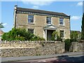
Bishop's Cleeve houses [10]
Southfield, number 21 Station Road, was probably built in the 19th century. Constructed of coursed limestone with ashlar quoins and dressings under a stone slate roof.
Bishop's Cleeve is a large village in Gloucestershire. It lies at the foot of Cleeve Hill, the highest point of the Cotswolds, some 3½ miles north of Cheltenham. Although Iron Age and Roman remains have been found locally, the earliest known origins of the village date to the 8th Century. A monastery and surrounding land was given to the Bishop of Worcester, and the village became the Bishop’s Cliffe. The village grew rapidly when an aerospace factory was built nearby after the Second World War and continues to grow.
Image: © Michael Dibb
Taken: 21 Jul 2021
0.18 miles