
IMAGES TAKEN NEAR TO
Millham Road, CHELTENHAM, GL52 8BB
Introduction
This page details the photographs taken nearby to Millham Road, GL52 8BB by members of the Geograph project.
The Geograph project started in 2005 with the aim of publishing, organising and preserving representative images for every square kilometre of Great Britain, Ireland and the Isle of Man.

There are currently over 7.5m images from over14,400 individuals and you can help contribute to the project by visiting https://www.geograph.org.uk
Image Map
Images are licensed for reuse under creativecommons.org/licenses/by-sa/2.0
Notes
- Clicking on the map will re-center to the selected point.
- The higher the marker number, the further away the image location is from the centre of the postcode.
Image Listing (133 Images Found)
Images are licensed for reuse under creativecommons.org/licenses/by-sa/2.0
Image
Details
Distance
1
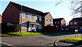
Cares Close
Housing on the northern edge of Bishop's Cleeve.
Image: © Jonathan Billinger
Taken: 17 Dec 2013
0.04 miles
2

Millham Road, Bishop's Cleeve
Suburban road in this dormitary village at the foot of Nottingham Hill.
Image: © Jonathan Billinger
Taken: 17 Dec 2013
0.05 miles
3
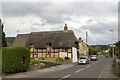
Jasmine Cottage
Cottage. C17. Square-panelled timber framing with limestone rubble and unpainted brick infill, on a limestone rubble plinth; gable end facing road limestone rubble and weatherboarded gable; thatched roof with decorative ridge thatching; red brick stack.
Image: © P Gaskell
Taken: Unknown
0.08 miles
4
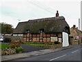
Bishop's Cleeve houses [17]
Number 79 Station Road is a 17th century cottage with a later, unsympathetic extension. Constructed of square-panelled timber framing with rubble and brick noggin, set on a rubble stone plinth with the gable end to the street in rubble stone and weatherboarded, all under a thatch roof. There is another view of the cottage at Image Listed, grade II, with details at: https://historicengland.org.uk/listing/the-list/list-entry/1091701
Bishop's Cleeve is a large village in Gloucestershire. It lies at the foot of Cleeve Hill, the highest point of the Cotswolds, some 3½ miles north of Cheltenham. Although Iron Age and Roman remains have been found locally, the earliest known origins of the village date to the 8th Century. A monastery and surrounding land was given to the Bishop of Worcester, and the village became the Bishop’s Cliffe. The village grew rapidly when an aerospace factory was built nearby after the Second World War and continues to grow.
Image: © Michael Dibb
Taken: 9 Nov 2021
0.08 miles
5
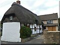
Bishop's Cleeve houses [18]
Number 79 Station Road is a 17th century cottage with a later, unsympathetic extension. Constructed of square-panelled timber framing with rubble and brick noggin, set on a rubble stone plinth with the gable end to the street in rubble stone and weatherboarded, all under a thatch roof. There is another view of the cottage at Image Listed, grade II, with details at: https://historicengland.org.uk/listing/the-list/list-entry/1091701
Bishop's Cleeve is a large village in Gloucestershire. It lies at the foot of Cleeve Hill, the highest point of the Cotswolds, some 3½ miles north of Cheltenham. Although Iron Age and Roman remains have been found locally, the earliest known origins of the village date to the 8th Century. A monastery and surrounding land was given to the Bishop of Worcester, and the village became the Bishop’s Cliffe. The village grew rapidly when an aerospace factory was built nearby after the Second World War and continues to grow.
Image: © Michael Dibb
Taken: 9 Nov 2021
0.08 miles
6
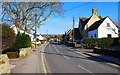
Station Road, Bishop's Cleeve, Glos
There are some older houses in this road but the village lost its station in March 1960. Although the line has been relaid by the Gloucestershire Warwickshire Railway, a heritage line, there are currently no plans for a station in the village.
Image: © P L Chadwick
Taken: 6 Apr 2013
0.09 miles
7
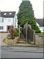
Bishop's Cleeve features [2]
From Station Road, this footpath leads to Priory Lane.
Bishop's Cleeve is a large village in Gloucestershire. It lies at the foot of Cleeve Hill, the highest point of the Cotswolds, some 3½ miles north of Cheltenham. Although Iron Age and Roman remains have been found locally, the earliest known origins of the village date to the 8th Century. A monastery and surrounding land was given to the Bishop of Worcester, and the village became the Bishop’s Cliffe. The village grew rapidly when an aerospace factory was built nearby after the Second World War and continues to grow.
Image: © Michael Dibb
Taken: 9 Nov 2021
0.10 miles
8
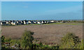
The Edge of Bishop's Cleeve
Newly built houses, viewed from a passing train on the Gloucestershire Warwickshire Railway on a lovely mid-October day.
Image: © Mary and Angus Hogg
Taken: 17 Oct 2017
0.10 miles
9
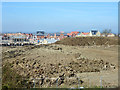
New housing, Bishop's Cleeve
This is an extension of the village northwards into former farm land.
Image: © Robin Webster
Taken: 6 Apr 2015
0.10 miles
10
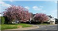
Spring is here.
A very good indication of the arrival of Spring, are the trees at the bottom of Millham Road in Bishop's Cleeve. They look splendid when they are in full blossom.
Image: © Helen Iwanczuk
Taken: 12 Apr 2019
0.10 miles