
IMAGES TAKEN NEAR TO
Ruby Avenue, GL52 7AD
Introduction
This page details the photographs taken nearby to Ruby Avenue, GL52 7AD by members of the Geograph project.
The Geograph project started in 2005 with the aim of publishing, organising and preserving representative images for every square kilometre of Great Britain, Ireland and the Isle of Man.

There are currently over 7.5m images from over14,400 individuals and you can help contribute to the project by visiting https://www.geograph.org.uk
Image Map
Images are licensed for reuse under creativecommons.org/licenses/by-sa/2.0
Notes
- Clicking on the map will re-center to the selected point.
- The higher the marker number, the further away the image location is from the centre of the postcode.
Image Listing (10 Images Found)
Images are licensed for reuse under creativecommons.org/licenses/by-sa/2.0
Image
Details
Distance
1
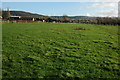
Dean Farm, Bishop's Cleeve
Dean Farm, viewed here from a passing footpath is situated just beyond the sprawl of housing which has expanded the village. Modern houses can be seen in the background.
Image: © Philip Halling
Taken: 6 Dec 2009
0.12 miles
2
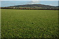
Nottingham Hill
Nottingham Hill viewed from a footpath near Dean Farm. The white building in the middle distance on the left is The Farmers, formerly the Farmers Arms, on the A435 just north of Bishop's Cleeve.
Image: © Philip Halling
Taken: 6 Dec 2009
0.13 miles
3
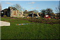
Collapsed farm building, Dean Farm
This farm building at Dean Farm near Bishop's Cleeve has clearly seen better days. Here it is viewed from a passing footpath.
Image: © Philip Halling
Taken: 6 Dec 2009
0.14 miles
4
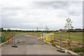
Sapphire Road
New housing development at Sapphire Road
Image: © P Gaskell
Taken: Unknown
0.14 miles
5
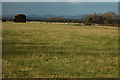
Barn and sheep at Bishop's Cleeve
Sheep in a field beside a dutch barn near Dean Farm, Bishop's Cleeve.
Image: © Philip Halling
Taken: 6 Dec 2009
0.17 miles
6
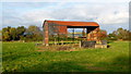
Dutch barn near Dean Farm
Situated by the public path west of Bishop's Cleeve.
Oxenton Hill can be seen through the building.
Image: © Jonathan Billinger
Taken: 26 Oct 2012
0.17 miles
7
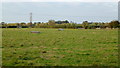
Sheep pasture, Bishop's Cleeve
Looking along the line of the footpath to Gotherington Field Farm.
Bob's view of the Malvern Hills in the first Geograph for this square - Image - is obscured by autumnal cloud.
Image: © Jonathan Billinger
Taken: 26 Oct 2012
0.18 miles
8
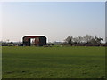
Old barn near Dean Farm
View across the fields towards the old barn at Dean Farm. Taken on footpath leading from Little Acorns
Image: © Rob Coldwell
Taken: 1 Apr 2007
0.18 miles
9
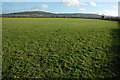
Grazing land near Bishop's Cleeve
A field to the north-west of Dean Farm, Bishop's Cleeve, Nottingham Hill and Cleeve Hill are in the background.
Image: © Philip Halling
Taken: 6 Dec 2009
0.24 miles
10
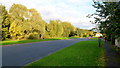
Hayfield Way, Bishop's Cleeve
Afternoon autumnal sunshine illuminates the willows marking the (current) boundary between suburbia and pasture.
Image: © Jonathan Billinger
Taken: 26 Oct 2012
0.24 miles