IMAGES TAKEN NEAR TO
All Saints Terrace, CHELTENHAM, GL52 6UA
Introduction
This page details the photographs taken nearby to All Saints Terrace, GL52 6UA by members of the Geograph project.
The Geograph project started in 2005 with the aim of publishing, organising and preserving representative images for every square kilometre of Great Britain, Ireland and the Isle of Man.

There are currently over 7.5m images from over14,400 individuals and you can help contribute to the project by visiting https://www.geograph.org.uk
Image Map
Images are licensed for reuse under creativecommons.org/licenses/by-sa/2.0
Notes
- Clicking on the map will re-center to the selected point.
- The higher the marker number, the further away the image location is from the centre of the postcode.
Image Listing (49 Images Found)
Images are licensed for reuse under creativecommons.org/licenses/by-sa/2.0
Image
Details
Distance
1
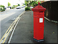
Hewlett Road, Cheltenham
Thanks to Google Earth I can locate both viewpoint and subject grid references to the metre. The viewpoint can be seen in this image http://www.geograph.org.uk/photo/1363466 which also links to another photograph of the Penfold Victorian pillarbox.
Image: © Brian Robert Marshall
Taken: 20 Jun 2009
0.06 miles
2
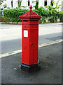
Penfold Victorian pillar box, Hewlett Road, Cheltenham
Cheltenham has several of these rather attractive pillar boxes. I was lucky to spot it on my way through this part of the Borough.
Image: © Brian Robert Marshall
Taken: 20 Jun 2009
0.06 miles
3
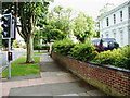
Pittville Circus Road, Cheltenham
This is a view south along the road to its junction with Hewlett Road. Just discerrnible at left of centre is another Penfold Victorian pillar box http://www.geograph.org.uk/photo/1363465
Image: © Brian Robert Marshall
Taken: 20 Jun 2009
0.07 miles
4
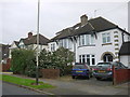
Houses on Eldon Rd
These 1930's semi detached brick built houses are on Eldon Rd just west of the junction with Hale's Rd.
Image: © Nigel Mykura
Taken: 10 Dec 2015
0.13 miles
5
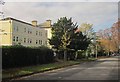
Pittville Circus Road, Cheltenham
From the junction with Hayes Road.
Image: © Derek Harper
Taken: 25 Oct 2014
0.14 miles
8
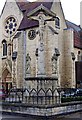
War Memorial (2), All Saints Church, All Saints Road, Cheltenham
This is the front of the memorial, but unfortunately being set against the background of the church, with similar coloured stone, it is not too easy to make out the details.
For more about the memorial, please see:- Image
Image: © P L Chadwick
Taken: 6 Mar 2011
0.17 miles
9
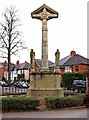
War Memorial (1), All Saints Church, All Saints Road, Cheltenham
This war memorial has been placed within the church grounds, by the corner of All Saints Road, and All Saints Villas Road. It is not Cheltenham's main War Memorial, which is to be found in the Promenade, in the town centre. The memorial at All Saints Church, is in respect of those connected with the church who died in the Great (First World) War of 1914-18. There are 103 names recorded, but due to weathering, many names are illegible. Fortunately the Church has a parchment Roll of Honour, on which all the names are recorded.
The War Memorial, which dates from around 1920, is Grade II listed. Part of the listing text says:- "The memorial is in the form of a Calvary scene, with Christ on the cross flanked by figures of Mary Magdalene and the Virgin Mary and set on a tall plinth inscribed with the names of the fallen. The Lamb of God is carved on the rear face of the cross-head".
Image
Image: © P L Chadwick
Taken: 6 Mar 2011
0.17 miles