
IMAGES TAKEN NEAR TO
Birdlip Road, CHELTENHAM, GL52 5AJ
Introduction
This page details the photographs taken nearby to Birdlip Road, GL52 5AJ by members of the Geograph project.
The Geograph project started in 2005 with the aim of publishing, organising and preserving representative images for every square kilometre of Great Britain, Ireland and the Isle of Man.

There are currently over 7.5m images from over14,400 individuals and you can help contribute to the project by visiting https://www.geograph.org.uk
Image Map
Images are licensed for reuse under creativecommons.org/licenses/by-sa/2.0
Notes
- Clicking on the map will re-center to the selected point.
- The higher the marker number, the further away the image location is from the centre of the postcode.
Image Listing (20 Images Found)
Images are licensed for reuse under creativecommons.org/licenses/by-sa/2.0
Image
Details
Distance
1
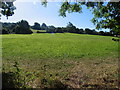
Lower Slopes of Aggs Hill
The eastern half of this square consists of the lower slopes of Aggs Hill and is nearly all lightly wooded grassland.
Image: © Terry Jacombs
Taken: 21 Aug 2005
0.06 miles
2
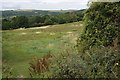
View to Cleeve Hill
View to Cleeve Hill and the highest point in the Cotswold Hills from below Hewletts Lower Farm.
Image: © Philip Halling
Taken: 13 Aug 2011
0.10 miles
3
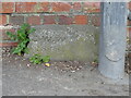
Old Boundary Marker on Aggs Hill, Charlton Kings
Water Company Boundary Marker beside a lamppost at the foot of a brick wall on the west side of the junction of Birdlip Road, Harp Hill and Aggs Hill. Charlton Kings parish. Inscribed C.W.W. / 1848. Marking the boundary of Cheltenham Water Works' Hewletts Reservoir. Reservoir No.3 was completed in 1847. The reservoir gates, gate piers and boundary walls are Grade II Listed https://historicengland.org.uk/listing/the-list/list-entry/1104330. Although the stone is not mentioned, the List Entry contains information about the development of the reservoir.
Milestone Society National ID: GL_CHARLT01em
Image: © Roadside Relics
Taken: 14 Apr 2022
0.11 miles
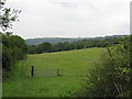
6
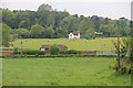
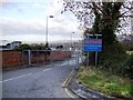
Hewletts Reservoir from Aggs Hill
The reservoir used to be open but was completely covered sometime in the latter years of the last century.
Image: © Terry Jacombs
Taken: 29 May 2012
0.13 miles
7
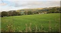
Ridge and furrow near Cheltenham
In the distance is Cleeve Common and Cleeve Hill. View from Harp Hill.
Image: © Derek Harper
Taken: 25 Oct 2014
0.15 miles
9
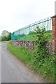
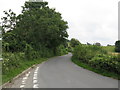
Hewletts Reservoir eastern perimeter fence
Image: © Terry Jacombs
Taken: 29 May 2012
0.16 miles
10
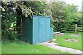
Water analysis hut, Hewletts Reservoir
Image: © Terry Jacombs
Taken: 29 May 2012
0.17 miles