
IMAGES TAKEN NEAR TO
Haymes Drive, CHELTENHAM, GL52 3QQ
Introduction
This page details the photographs taken nearby to Haymes Drive, GL52 3QQ by members of the Geograph project.
The Geograph project started in 2005 with the aim of publishing, organising and preserving representative images for every square kilometre of Great Britain, Ireland and the Isle of Man.

There are currently over 7.5m images from over14,400 individuals and you can help contribute to the project by visiting https://www.geograph.org.uk
Image Map
Images are licensed for reuse under creativecommons.org/licenses/by-sa/2.0
Notes
- Clicking on the map will re-center to the selected point.
- The higher the marker number, the further away the image location is from the centre of the postcode.
Image Listing (8 Images Found)
Images are licensed for reuse under creativecommons.org/licenses/by-sa/2.0
Image
Details
Distance
1

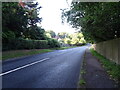
Old Milestone, B4632 Southam
On the SE verge of the road that by-passes Southam, NE of the village. 392.2 ft ASL in 1901 (BM not visible nor in OS database). Carved stone post, Winchcombe stone design, erected by the Winchcomb District turnpike trust in the 19th century.
Inscription (was): Winchcomb 4 // Cheltenham 3
Milestone Society National ID: GL_CMWC03
Image: © Mr Red
Taken: 22 Jan 2022
0.06 miles
3
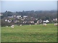
Houses on New Road
Seen from the footpath from Southam to Bishop's Cleeve. Cleeve Hill rises behind the houses but is hidden in low cloud. The field in the foreground shows clear signs of the Medieval ridge and furrow ploughing system.
Image: © Michael Dibb
Taken: 18 Jan 2010
0.15 miles
4
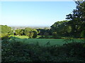
Grazing and woodland near Southam
Looking down from the B4632.
Image: © JThomas
Taken: 12 Aug 2021
0.21 miles
5
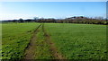
Looking west from New Road
Pasture land on the heavy soils at the base of the Cotswold scarp.
Image: © Jonathan Billinger
Taken: 30 Jan 2016
0.21 miles
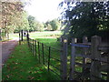
7
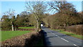
New Road, looking north
Cuts out the hill between Southam and Woodmancote.
Image: © Jonathan Billinger
Taken: 30 Jan 2016
0.22 miles
8
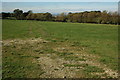
Fields near Southam
Fields of the Woodmancote to Southam road.
Image: © Philip Halling
Taken: 11 Oct 2008
0.24 miles