
IMAGES TAKEN NEAR TO
Park Lane, CHELTENHAM, GL52 3BN
Introduction
This page details the photographs taken nearby to Park Lane, GL52 3BN by members of the Geograph project.
The Geograph project started in 2005 with the aim of publishing, organising and preserving representative images for every square kilometre of Great Britain, Ireland and the Isle of Man.

There are currently over 7.5m images from over14,400 individuals and you can help contribute to the project by visiting https://www.geograph.org.uk
Image Map
Images are licensed for reuse under creativecommons.org/licenses/by-sa/2.0
Notes
- Clicking on the map will re-center to the selected point.
- The higher the marker number, the further away the image location is from the centre of the postcode.
Image Listing (22 Images Found)
Images are licensed for reuse under creativecommons.org/licenses/by-sa/2.0
Image
Details
Distance
1
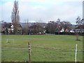
Park Lane, Prestbury
These houses in Park Lane are seen from the footpath around the perimeter of the racecourse.
Image: © Michael Dibb
Taken: 18 Jan 2010
0.02 miles
2
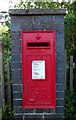
George V postbox on Spring Lane, Prestbury
Postbox No. GL52 171.
Image: © JThomas
Taken: 12 Aug 2021
0.06 miles
3
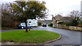
Looking along Shaw Green Lane
The tree in the centre of the grass circle looks to be a hawthorn and is heavily laden with mistletoe.
Image: © Jonathan Billinger
Taken: 12 Dec 2014
0.07 miles
4
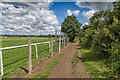
Footpath around the racecourse
View north along the public footpath around the outside of Cheltenham Racecourse.
Image: © David P Howard
Taken: 14 Jul 2016
0.10 miles
5
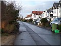
Shaw Green Lane, Prestbury
Seen from near to where the footpath to Southam crosses the road.
Image: © Michael Dibb
Taken: 18 Jan 2010
0.12 miles
6
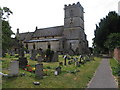
St Mary's Church, Prestbury, Cheltenham
Sited on Mill Street which is a quiet lane running parallel with the main road through Prestbury, the church is at the extreme southern edge of this square, and parts of the building and churchyard are in SO9623. Taken at SO969 240 facing South East
Image: © Terry Jacombs
Taken: 11 Aug 2005
0.12 miles
7
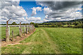
Footpath around the racecourse
View north along the public footpath around the outside of Cheltenham Racecourse.
Image: © David P Howard
Taken: 14 Jul 2016
0.15 miles
8
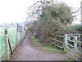
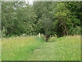
Racecourse footpath
The footpath follows the perimeter of the racecourse on its way to Prestbury. Another path leads to Bow Bridge through the kissing gate on the right.
Image: © Michael Dibb
Taken: 18 Jan 2010
0.18 miles
10
![Prestbury houses [27]](https://s1.geograph.org.uk/geophotos/06/92/24/6922477_849e4459_120x120.jpg)
Prestbury houses [27]
Pilgrim Cottage in Lake Street is a 17th century detached house, gable end to the street. Timber framed on a stone plinth under a stone slate roof. The gable end facing the street has been encased in brick, the far gable end rebuilt in stone. Listed, grade II, with details at: https://historicengland.org.uk/listing/the-list/list-entry/1091904
The village of Prestbury, occupied since Saxon times, is some 1½ miles northeast of the town of Cheltenham, which it once rivalled as a commercial centre. A market was established in 1249, but it declined and the historic village is now merely a suburb of the larger town. The village is home to Prestbury Park, the Cheltenham Racecourse. The village is reputed to be one of the most haunted places in Britain.
Image: © Michael Dibb
Taken: 20 May 2021
0.21 miles