
IMAGES TAKEN NEAR TO
Albert Road, CHELTENHAM, GL52 2TN
Introduction
This page details the photographs taken nearby to Albert Road, GL52 2TN by members of the Geograph project.
The Geograph project started in 2005 with the aim of publishing, organising and preserving representative images for every square kilometre of Great Britain, Ireland and the Isle of Man.

There are currently over 7.5m images from over14,400 individuals and you can help contribute to the project by visiting https://www.geograph.org.uk
Image Map
Images are licensed for reuse under creativecommons.org/licenses/by-sa/2.0
Notes
- Clicking on the map will re-center to the selected point.
- The higher the marker number, the further away the image location is from the centre of the postcode.
Image Listing (101 Images Found)
Images are licensed for reuse under creativecommons.org/licenses/by-sa/2.0
Image
Details
Distance
1
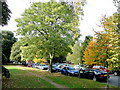
Leafy Pittville 2
An extension of Pittville Park south towards Cheltenham town centre.
Image: © Jonathan Billinger
Taken: 24 Sep 2009
0.03 miles
2
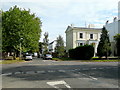
Leafy Pittville 4
A fine Regency mansion on the corner of Pittville Lawn and Central Cross Drive.
Image: © Jonathan Billinger
Taken: 24 Sep 2009
0.04 miles
3
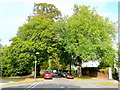
Leafy Pittville 3
Looking north along Pittville Lawn.
Image: © Jonathan Billinger
Taken: 24 Sep 2009
0.05 miles
4
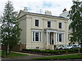
Regency Lodge, Pittville Lawn, Cheltenham
Built c1835. What distinguishes it from so many three-bay villas in Cheltenham is the all-over horizontal rustication. Rich Corinthian porch. Grade II listed.
Image: © Stephen Richards
Taken: 20 May 2015
0.05 miles
5
![Cheltenham houses [145]](https://s0.geograph.org.uk/geophotos/06/91/83/6918380_f392b86d_120x120.jpg)
Cheltenham houses [145]
Numbers 59 to 67 Pittville Lawn are a terrace of five houses, built in 1838. Constructed of stuccoed brick with fine detailing, under a concealed roof with iron railings and balcony. Some original internal features remain. Listed, grade II, with details at: https://historicengland.org.uk/listing/the-list/list-entry/1387472
Cheltenham is located at the foot of the Cotswold scarp with the small River Chelt flowing through the town. After the discovery of mineral springs in 1716 Cheltenham became a spa town and many Regency houses and other buildings were erected. The town is home to the renowned Cheltenham Festival, four days of horse jump racing culminating in the Gold Cup, held annually in March at the nearby racecourse.
Image: © Michael Dibb
Taken: 19 May 2021
0.06 miles
6
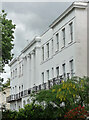
59-67 Pittville Lawn, Cheltenham
The last of three terraces on the street built to the same designs (Image]). Grade II listed.
Image: © Stephen Richards
Taken: 20 May 2015
0.06 miles
7
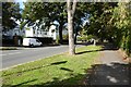
Albert Road
Albert Road in Pittville, Cheltenham.
Image: © Philip Halling
Taken: 16 Sep 2022
0.06 miles
8
![Cheltenham houses [144]](https://s3.geograph.org.uk/geophotos/06/91/83/6918375_65db5a93_120x120.jpg)
Cheltenham houses [144]
Wyddrington House, number 55 Pittville Lawn, is a detached villa, now flats. Built in 1837 of stuccoed brick with fine detailing, under a concealed roof and with an iron balcony. Listed, grade II, with details at: https://historicengland.org.uk/listing/the-list/list-entry/1387471
Cheltenham is located at the foot of the Cotswold scarp with the small River Chelt flowing through the town. After the discovery of mineral springs in 1716 Cheltenham became a spa town and many Regency houses and other buildings were erected. The town is home to the renowned Cheltenham Festival, four days of horse jump racing culminating in the Gold Cup, held annually in March at the nearby racecourse.
Image: © Michael Dibb
Taken: 19 May 2021
0.07 miles
9
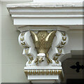
Detail of 16 Albert Road, Cheltenham
These striking gilded capitals at the porch feature buzzards.
Image: © Stephen Richards
Taken: 20 May 2015
0.07 miles
10
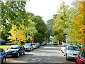
Leafy Pittville 1
Parkland area to the north of Cheltenham town centre. Looking west along Central Cross Drive.
Image: © Jonathan Billinger
Taken: 24 Sep 2009
0.08 miles