1
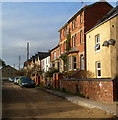
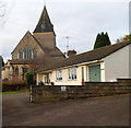
Uplands Road, Stroud
Uplands Road is a 100 metre long residential cul-de-sac. This view is from the Springfield Road end
near Uplands Post Office. http://www.geograph.org.uk/photo/3304447
Image: © Jaggery
Taken: 8 Jan 2012
0.08 miles
2
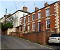
Uplands Cottages, Stroud
Uplands Cottages are the row of three dwellings in the foreground.
Viewed from the edge of Uplands Post Office http://www.geograph.org.uk/photo/3304447 looking across Springfield Road.
Image: © Jaggery
Taken: 8 Jan 2012
0.09 miles
3
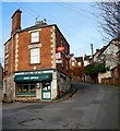
Uplands Post Office, Stroud
Located in Springfield House, at the junction of Uplands Road and Springfield Road (on the right), Uplands Post Office is a rare example of a post office reopening after being closed down.
In 2008, this post office was one of seven in the Stroud area to be closed, as part of the cost-cutting exercise which closed 2,500 post offices in the UK.
After a vigorous local campaign, and financial support from Stroud town council, the post office reopened a few months after closure. A key factor was a High Court ruling that a local 74-year-old disabled person would be discriminated against because of the difficulties she would face getting to another post office.
Image: © Jaggery
Taken: 8 Jan 2012
0.10 miles
4
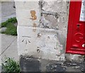
Ordnance Survey Cut Mark
This OS cut mark can be found on the Post Office. It marks a point 65.017m above mean sea level.
Image: © Adrian Dust
Taken: 13 Sep 2016
0.11 miles
5
Uplands Sub Post Office, Stroud
Another view of
Image, showing off
Image Uplands Road is on the left.
Image: © Derek Harper
Taken: 19 Oct 2007
0.11 miles
6
George V postbox, Uplands
A wall-mounted box bearing the distinctive little crown. One of the quoins of
Image bears a benchmark - 65.02 metres above sea level, according to the map.
Image: © Derek Harper
Taken: 19 Oct 2007
0.11 miles
7
Uplands Sub Post Office, Stroud
Housed in a distinctively shaped building on the corner of Uplands Road (left) and Springfield Road (right), on the steep slopes of the Slad valley.
Image: © Derek Harper
Taken: 19 Oct 2007
0.11 miles
8
East side of All Saints Church, Stroud
Viewed from Sycamore Drive.
Image: © Jaggery
Taken: 8 Jan 2012
0.11 miles
9
B4070 Slad Road, Stroud
A 20 limit with chicanes and long lines of parked cars on a narrow road.
Image: © Robin Webster
Taken: 9 Jan 2022
0.12 miles
10
View from Belle Vue Road, Stroud
The church is All Saints. http://www.geograph.org.uk/photo/3305064
Image: © Jaggery
Taken: 28 Dec 2014
0.12 miles


