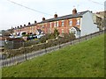
IMAGES TAKEN NEAR TO
Clare Court, STROUD, GL5 1NW
Introduction
This page details the photographs taken nearby to Clare Court, GL5 1NW by members of the Geograph project.
The Geograph project started in 2005 with the aim of publishing, organising and preserving representative images for every square kilometre of Great Britain, Ireland and the Isle of Man.

There are currently over 7.5m images from over14,400 individuals and you can help contribute to the project by visiting https://www.geograph.org.uk
Image Map
Images are licensed for reuse under creativecommons.org/licenses/by-sa/2.0
Notes
- Clicking on the map will re-center to the selected point.
- The higher the marker number, the further away the image location is from the centre of the postcode.
Image Listing (34 Images Found)
Images are licensed for reuse under creativecommons.org/licenses/by-sa/2.0
Image
Details
Distance
1
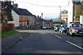
Bisley Old Road, Stroud
Towards the town centre.
Image: © Robin Webster
Taken: 9 Jan 2022
0.06 miles
2
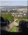
Path from Summer Street
The path descends steeply between fences and then runs along the edge of a field. As it drops into the Slad Brook valley it crosses into SO8505, which is where much of the housing in Uplands on the north side of the valley is located. In the left distance is Whiteshill.
Image: © Derek Harper
Taken: 19 Oct 2007
0.09 miles
3
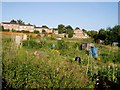
Bisley Old Road Allotments, Stroud
One of a number of allotments in Stroud, sandwiched between post-WW2 housing developments.
Image: © David Gruar
Taken: 3 Aug 2006
0.15 miles
4
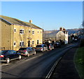
Summer Street, Stroud
East of Parliament Street.
Image: © Jaggery
Taken: 28 Dec 2014
0.17 miles
5
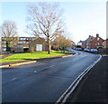
Bisley Old Road, Stroud
Looking east from the Parliament Street, Hollow Lane and Summer Street junctions.
Image: © Jaggery
Taken: 28 Dec 2014
0.17 miles
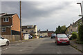

8
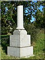
Stroud cemetery, Bisley Road, Stroud
The Victorians, certainly wealthy ones, loved symbolism and grave monuments often contained imagery that reflected some aspect of the deceased. In this case the broken pillar represents a life cut short. It is dated 1910 so is Edwardian but presumably the Victorian ideals still held sway at that time. There are many more examples of symbolism in the cemetery that I didn't have time to record. Similar examples exist in Wiltshire http://www.geograph.org.uk/photo/1209861 and http://www.geograph.org.uk/photo/1742226
Image: © Brian Robert Marshall
Taken: 9 Feb 2008
0.19 miles
9
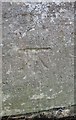
Ordnance Survey Cut Mark
This OS cut mark can be found on a wall post of the cemetery on Bisley Road. It marks a point 138.029m above mean sea level.
Image: © Adrian Dust
Taken: 13 Sep 2016
0.20 miles