
IMAGES TAKEN NEAR TO
Bisley Old Road, STROUD, GL5 1NG
Introduction
This page details the photographs taken nearby to Bisley Old Road, GL5 1NG by members of the Geograph project.
The Geograph project started in 2005 with the aim of publishing, organising and preserving representative images for every square kilometre of Great Britain, Ireland and the Isle of Man.

There are currently over 7.5m images from over14,400 individuals and you can help contribute to the project by visiting https://www.geograph.org.uk
Image Map
Images are licensed for reuse under creativecommons.org/licenses/by-sa/2.0
Notes
- Clicking on the map will re-center to the selected point.
- The higher the marker number, the further away the image location is from the centre of the postcode.
Image Listing (27 Images Found)
Images are licensed for reuse under creativecommons.org/licenses/by-sa/2.0
Image
Details
Distance
1
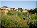
Bisley Old Road Allotments, Stroud
One of a number of allotments in Stroud, sandwiched between post-WW2 housing developments.
Image: © David Gruar
Taken: 3 Aug 2006
0.06 miles
2
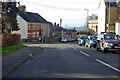
Bisley Old Road, Stroud
Towards the town centre.
Image: © Robin Webster
Taken: 9 Jan 2022
0.06 miles
4
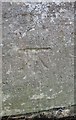
Ordnance Survey Cut Mark
This OS cut mark can be found on a wall post of the cemetery on Bisley Road. It marks a point 138.029m above mean sea level.
Image: © Adrian Dust
Taken: 13 Sep 2016
0.13 miles
5
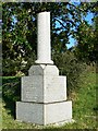
Stroud cemetery, Bisley Road, Stroud
The Victorians, certainly wealthy ones, loved symbolism and grave monuments often contained imagery that reflected some aspect of the deceased. In this case the broken pillar represents a life cut short. It is dated 1910 so is Edwardian but presumably the Victorian ideals still held sway at that time. There are many more examples of symbolism in the cemetery that I didn't have time to record. Similar examples exist in Wiltshire http://www.geograph.org.uk/photo/1209861 and http://www.geograph.org.uk/photo/1742226
Image: © Brian Robert Marshall
Taken: 9 Feb 2008
0.13 miles
6
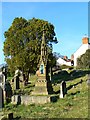
Stroud cemetery, Bisley Road, Stroud
An ornate grave memorial demonstrates the seriousness of the Victorian way of death. Such monuments were testimony to the wealth of those who commissioned them.
Image: © Brian Robert Marshall
Taken: 9 Feb 2008
0.14 miles
7

Stroud cemetery chapel, Bisley Road, Stroud
This is the chapel as viewed from Rodborough Common. More in this http://www.geograph.org.uk/photo/683826
Image: © Brian Robert Marshall
Taken: 14 May 2008
0.15 miles
8
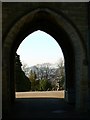
Stroud cemetery chapel, porte-cochere, Bisley Road, Stroud
The second of three views to the west through the chapel's porte-cochere. Some of the fairly ornate Victorian graves can be seen to the right. The cemetery is built on a south-facing slope with the chapel near the high point.
Image: © Brian Robert Marshall
Taken: 9 Feb 2008
0.15 miles
9
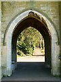
Stroud cemetery chapel, porte-cochere, Bisley Road, Stroud
The porte-cochere served to shelter the horse-drawn hearses while coffins were taken into one of the two chapels linked by it to the right and left. One of the pathways through the cemetery can be seen through the arch.
Image: © Brian Robert Marshall
Taken: 9 Feb 2008
0.15 miles
10
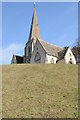
Stroud Cemetery chapel
Stroud Cemetery is on the steep Stroud valley hillside, here the chapel is viewed from below.
Image: © Philip Halling
Taken: 10 Mar 2012
0.16 miles