
IMAGES TAKEN NEAR TO
Queen Street, CHELTENHAM, GL51 9AU
Introduction
This page details the photographs taken nearby to Queen Street, GL51 9AU by members of the Geograph project.
The Geograph project started in 2005 with the aim of publishing, organising and preserving representative images for every square kilometre of Great Britain, Ireland and the Isle of Man.

There are currently over 7.5m images from over14,400 individuals and you can help contribute to the project by visiting https://www.geograph.org.uk
Image Map
Images are licensed for reuse under creativecommons.org/licenses/by-sa/2.0
Notes
- Clicking on the map will re-center to the selected point.
- The higher the marker number, the further away the image location is from the centre of the postcode.
Image Listing (76 Images Found)
Images are licensed for reuse under creativecommons.org/licenses/by-sa/2.0
Image
Details
Distance
1
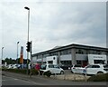
Volkswagen dealers, Tewkesbury Road, Cheltenham
Image: © David Smith
Taken: 15 Aug 2022
0.09 miles
2
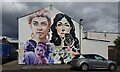
Street Art in Cheltenham
One of the many beautiful murals painted onto ordinary buildings in Cheltenham.
Information about the murals can be found in the link below.
Inspiring City https://inspiringcity.com › ... › Cheltenham Paint Festival
Image: © Helen Iwanczuk
Taken: 27 Jun 2022
0.09 miles
3
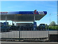
Tesco Filling Station on Tewkesbury Road
Image: © Eirian Evans
Taken: 2 May 2011
0.10 miles
5
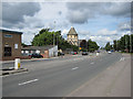
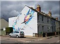
Tewkesbury Road, Cheltenham
This area of the town is known as St Peter's, after the neo-Norman church with its distinctive round tower. The road heads NW to junction 10, a restricted junction on the M5.
Image: © Pauline E
Taken: 4 Jul 2008
0.12 miles
6
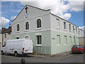
Gas Green Baptist Church
Russell Street/ Baker Street, Cheltenham. Built circa 1836. The building has been used by various denominations including Independents, Primitive Methodists and now by the Baptists. Originally the church was sited on the southern side of Tewkesbury Road but was demolished in 1836 when the gas works was extended.
Image: © Pauline E
Taken: 4 Jul 2008
0.12 miles
7
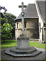
War memorial, St Peter's, Cheltenham
A stone cross on a stone base with three panels recording the names of 134 local men who died during WWI. Dedicated and unveiled, Sunday October 10th, 1920.
Image: © Pauline E
Taken: 4 Jul 2008
0.15 miles
8
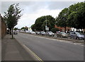
Tewkesbury Road, Cheltenham
The A4019 Tewkesbury Road from the corner of Gloucester Road.
Image: © Jaggery
Taken: 3 Aug 2016
0.15 miles
9
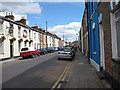
Adam & Eve pub, Townsend Street
One of several streets of terraced housing opposite the former gas works.
Image: © Pauline E
Taken: 4 Jul 2008
0.16 miles
10
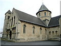
St. Peter's church, Cheltenham
Viewed from the south-west.
Image: © Jonathan Billinger
Taken: 28 Feb 2009
0.16 miles