1
Crickmore Vets in Cheltenham
Veterinary practice in Albion Lodge, 1 Gloucester Road.
Image: © Jaggery
Taken: 3 Aug 2016
0.01 miles
2
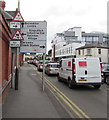
Queuing traffic, Gloucester Road, Cheltenham
Two warning signs and three items of direction information face eastbound vehicles on the B4633 Gloucester Road. If queuing at traffic lights is typical here, drivers new to the area should have enough time to see any relevant information.
Image: © Jaggery
Taken: 3 Aug 2016
0.01 miles
3
Stoneville Street towards Gloucester Road, Cheltenham
Viewed from near this wall http://www.geograph.org.uk/photo/5140382 looking towards Gloucester Road 95 metres ahead.
Image: © Jaggery
Taken: 3 Aug 2016
0.01 miles
4
Offices on Tewkesbury Road, Cheltenham
This appears to have been a school looking around the building
Image: © David Howard
Taken: 3 Aug 2019
0.02 miles
5
Buildings for former gas works, Gloucester Road, Cheltenham
Now commercially used and the main site is a Tesco supermarket; these buildings are listed grade II
Image: © David Smith
Taken: 14 Aug 2022
0.02 miles
6
Gloucester Road arches, Cheltenham
At the edge of this http://www.geograph.org.uk/photo/5597189 Tesco superstore.
The site was formerly occupied by Cheltenham Gas Works.
Image: © Jaggery
Taken: 3 Aug 2016
0.02 miles
7
Halls Brewery name plaque on a Cheltenham wall
The Halls Oxford & West Brewery Company Limited ceramic plaque
is on the left here, http://www.geograph.org.uk/photo/5140441 on the wall of the derelict former Junction pub.
Image: © Jaggery
Taken: 3 Aug 2016
0.02 miles
8
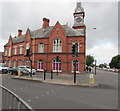
Grade II listed former Cheltenham Gas Company Building, Cheltenham
Viewed across Gloucester Road. The redbrick building dates from 1880, with later alterations. The words CHELTENHAM GAS COMPANY are below a first floor window on the right. Grade II listed in 1998.
Image: © Jaggery
Taken: 3 Aug 2016
0.02 miles
9
Former gas works site
Now redeveloped by a well known supermarket chain. To the right, the clock tower of the old gas works offices can be seen.
Image: © Pauline E
Taken: 4 Jul 2008
0.03 miles
10
Derelict former pub on a Cheltenham corner
The former Junction pub at 14 Gloucester Road on the corner of Bloomsbury Street viewed in early Aug 2016.
A year earlier, a local newspaper reported that the Borough Council was considering the planning application to demolish the Junction pub and build two houses on the site.
Image: © Jaggery
Taken: 3 Aug 2016
0.03 miles


