
IMAGES TAKEN NEAR TO
Arle Road, CHELTENHAM, GL51 8LA
Introduction
This page details the photographs taken nearby to Arle Road, GL51 8LA by members of the Geograph project.
The Geograph project started in 2005 with the aim of publishing, organising and preserving representative images for every square kilometre of Great Britain, Ireland and the Isle of Man.

There are currently over 7.5m images from over14,400 individuals and you can help contribute to the project by visiting https://www.geograph.org.uk
Image Map
Images are licensed for reuse under creativecommons.org/licenses/by-sa/2.0
Notes
- Clicking on the map will re-center to the selected point.
- The higher the marker number, the further away the image location is from the centre of the postcode.
Image Listing (58 Images Found)
Images are licensed for reuse under creativecommons.org/licenses/by-sa/2.0
Image
Details
Distance
1
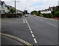
Junction of Arle Road and Alstone Croft, Cheltenham
Alstone Croft from the left joins Arle Road.
Image: © Jaggery
Taken: 3 Aug 2016
0.07 miles
2
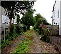
Path to Alstone Croft Playing Field, Cheltenham
From Alstone Croft. The notice shows
St Benedict's Catholic High School - Alstone Croft Playing Field - Private Property.
Image: © Jaggery
Taken: 3 Aug 2016
0.07 miles
3
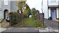
Access denied
The gate on the path to playing fields is chained up at the Alstone Croft end.
The fields are part of St. Benedict's RC school.
Image: © Jonathan Billinger
Taken: 1 Nov 2012
0.07 miles
4
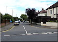
Arle Avenue, Cheltenham
On the northeast side of Arle Road.
Image: © Jaggery
Taken: 3 Aug 2016
0.07 miles
6
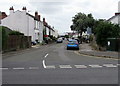
Alstone Croft, Cheltenham
Street on the southwest side of Arle Road.
Image: © Jaggery
Taken: 3 Aug 2016
0.08 miles
7
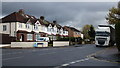
Arle Road, Alstone, Cheltenham
The lorry is heading for the nearby industrial estate.
Image: © Jonathan Billinger
Taken: 1 Nov 2012
0.08 miles
8
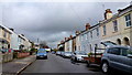
Alstone Croft, Cheltenham
The terrace on the right seems older than the semi's on the left.
Image: © Jonathan Billinger
Taken: 1 Nov 2012
0.10 miles
9
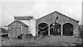
Derelict ex-Midland & South-Western Junction Locomotive Shed, Cheltenham 1950
View northward, with the ex-Midland main line to Birmingham over to the left beyond the M&SWJ High Street Sidings. It was closed 28/12/35, although M&SWJ trains from Cheltenham continued to start from the Midland Lansdown station until 9/58, then from the GWR station at St James' until ceasing altogether from 11/9/61.
Image: © Walter Dendy, deceased
Taken: 7 Jan 1950
0.10 miles
10
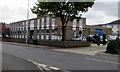
TA Centre, Cheltenham
Territorial Army Centre viewed across Arle Road from the corner of Arle Avenue.
Image: © Jaggery
Taken: 3 Aug 2016
0.10 miles