
IMAGES TAKEN NEAR TO
Gloucester Road, CHELTENHAM, GL51 7AS
Introduction
This page details the photographs taken nearby to Gloucester Road, GL51 7AS by members of the Geograph project.
The Geograph project started in 2005 with the aim of publishing, organising and preserving representative images for every square kilometre of Great Britain, Ireland and the Isle of Man.

There are currently over 7.5m images from over14,400 individuals and you can help contribute to the project by visiting https://www.geograph.org.uk
Image Map
Images are licensed for reuse under creativecommons.org/licenses/by-sa/2.0
Notes
- Clicking on the map will re-center to the selected point.
- The higher the marker number, the further away the image location is from the centre of the postcode.
Image Listing (128 Images Found)
Images are licensed for reuse under creativecommons.org/licenses/by-sa/2.0
Image
Details
Distance
1
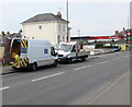
Severn Trent Water van and lorry in Cheltenham
Parked at the edge of the A40 Gloucester Road near a Texaco filling station.
Image: © Jaggery
Taken: 3 Apr 2016
0.02 miles
2
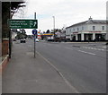
Distances sign facing the A40 Gloucester Road, Cheltenham
2¼ (miles) from Leckhampton, 2¾ from Charlton Kings and 3 from Prestbury.
TGI Fridays restaurant and bar at 374 Gloucester Road http://www.geograph.org.uk/photo/5026285 is on the right.
Image: © Jaggery
Taken: 3 Apr 2016
0.03 miles
3
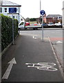
Cyclists Beware Pedestrians sign, Griffiths Avenue, Cheltenham
The sign is at the southern end of Griffiths Avenue, on the approach to the A40 Gloucester Road.
Image: © Jaggery
Taken: 3 Apr 2016
0.03 miles
4
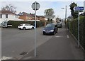
Cycle route direction sign facing Griffiths Avenue, Cheltenham
Turn left into Oldfield Crescent for the cycle route towards Benhall, Churchdown and Gloucester.
Image: © Jaggery
Taken: 3 Apr 2016
0.03 miles
5
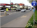
National Cycle Network Route 41 at the edge of Gloucester Road, Cheltenham
National Cycle Network Route 41 is here along the pavement on the north side of the A40 Gloucester Road.
The Sustrans website in early July 2016 states that National Cycle Network Route 41 is a long distance route that when complete will connect Bristol, Gloucester, Stratford-upon-Avon and Rugby.
Image: © Jaggery
Taken: 3 Apr 2016
0.03 miles
7
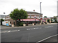
Restaurant, Cheltenham
TGI Fridays, where it's always Friday.
Image: © Pauline E
Taken: 27 Jun 2008
0.04 miles
8
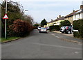
Warning sign - cyclists, Oldfield Crescent, Cheltenham
Facing Griffiths Avenue near the A40 Gloucester Road junction. http://www.geograph.org.uk/photo/4908395
Image: © Jaggery
Taken: 3 Apr 2016
0.04 miles
9
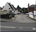
Granley Close, Cheltenham
Cul-de-sac on the south side of the A40 Gloucester Road.
Image: © Jaggery
Taken: 3 Apr 2016
0.04 miles
10
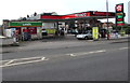
Red Apple Londis store and a Texaco filling station in Cheltenham
On the south side of the A40 Gloucester Road, on the corner of Granley Road.
Image: © Jaggery
Taken: 3 Apr 2016
0.04 miles