
IMAGES TAKEN NEAR TO
Badgeworth Road, CHELTENHAM, GL51 6SJ
Introduction
This page details the photographs taken nearby to Badgeworth Road, GL51 6SJ by members of the Geograph project.
The Geograph project started in 2005 with the aim of publishing, organising and preserving representative images for every square kilometre of Great Britain, Ireland and the Isle of Man.

There are currently over 7.5m images from over14,400 individuals and you can help contribute to the project by visiting https://www.geograph.org.uk
Image Map
Images are licensed for reuse under creativecommons.org/licenses/by-sa/2.0
Notes
- Clicking on the map will re-center to the selected point.
- The higher the marker number, the further away the image location is from the centre of the postcode.
Image Listing (19 Images Found)
Images are licensed for reuse under creativecommons.org/licenses/by-sa/2.0
Image
Details
Distance
4
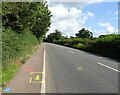
Markings on the B4063 towards Cheltenham
Looks like some roadworks are due.
Image: © JThomas
Taken: 10 Aug 2021
0.12 miles
7
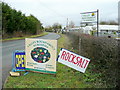
Nursery signage
By the Badgeworth Road, west of Cheltenham.
Image: © Jonathan Billinger
Taken: 6 Feb 2011
0.15 miles
9
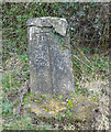
Old Boundary Marker on Badgeworth Road, Cheltenham
Municipal Boundary Marker on the southeast side of the junction of Bamfurlong Lane and Badgeworth Lane. On the boundary of Staverton, Gloucestershire and the Borough of Cheltenham. Inscribed CHELTENHAM and G. C. C. vertically on the left and right-hand sides with a vertical line between and B. OF C. / 1935 at the top. See https://www.geograph.org.uk/photo/7089451 for its current condition.
Milestone Society National ID: GL_STCM02pb
Image: © Mr Red
Taken: 8 Mar 2019
0.17 miles
10
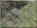
Old Boundary Marker on Badgeworth Road, Cheltenham
Municipal Boundary Marker on the southeast side of the junction of Bamfurlong Lane and Badgeworth Lane. On the boundary of Staverton, Gloucestershire and the Borough of Cheltenham. Inscribed CHELTENHAM and G. C. C. vertically on the left and right-hand sides with a vertical line between and B. OF C. / 1935 at the top. Now fallen, see https://www.geograph.org.uk/photo/6439123 to see it standing upright.
Milestone Society National ID: GL_STCM02pb
Image: © Roadside Relics
Taken: 2 Feb 2022
0.17 miles