
IMAGES TAKEN NEAR TO
Colesbourne Road, CHELTENHAM, GL51 6DJ
Introduction
This page details the photographs taken nearby to Colesbourne Road, GL51 6DJ by members of the Geograph project.
The Geograph project started in 2005 with the aim of publishing, organising and preserving representative images for every square kilometre of Great Britain, Ireland and the Isle of Man.

There are currently over 7.5m images from over14,400 individuals and you can help contribute to the project by visiting https://www.geograph.org.uk
Image Map
Images are licensed for reuse under creativecommons.org/licenses/by-sa/2.0
Notes
- Clicking on the map will re-center to the selected point.
- The higher the marker number, the further away the image location is from the centre of the postcode.
Image Listing (63 Images Found)
Images are licensed for reuse under creativecommons.org/licenses/by-sa/2.0
Image
Details
Distance
1
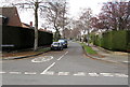
Colesbourne Road, Cheltenham
The NE end of Colesbourne Road, viewed across Robert Burns Avenue.
Colesbourne Road rejoins Robert Burns Avenue 300 metres to the SW.
Image: © Jaggery
Taken: 3 Apr 2016
0.05 miles
2
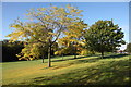
Benhall Parkland in Early Autumn
A view west along the line of Whittington Road. This is a view from the opposite direction of that shown in Image
Image: © Doug Lee
Taken: 14 Oct 2012
0.06 miles
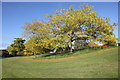
4
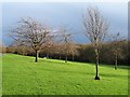
Parkland in Benhall
The parkland here is very popular place for walking dogs, kicking/hitting a ball of some form around, or just for "hanging out".
Image: © Doug Lee
Taken: 1 Dec 2007
0.08 miles
5
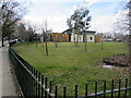
Towards Benhall Infant School and Pre-School, Cheltenham
Viewed from Robert Burns Avenue.
Image: © Jaggery
Taken: 3 Apr 2016
0.08 miles
6
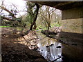
Hatherley Brook flows under Robert Burns Avenue, Cheltenham
Under this http://www.geograph.org.uk/photo/5002588 road bridge.
Image: © Jaggery
Taken: 3 Apr 2016
0.08 miles
7
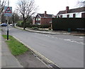
Patrol warning sign facing Robert Burns Avenue, Cheltenham
Opposite the Colesbourne Road junction http://www.geograph.org.uk/photo/5002659 on the approach to schools.
Image: © Jaggery
Taken: 3 Apr 2016
0.08 miles
8
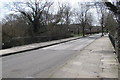
Road bridge over Hatherley Brook, Cheltenham
The bridge carries Robert Burns Avenue over Hatherley Brook.
Image: © Jaggery
Taken: 3 Apr 2016
0.09 miles
9
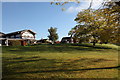
The National Hunt
The estate pub viewed from the parkland opposite
Image: © Doug Lee
Taken: 14 Oct 2012
0.09 miles
10
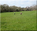
Walking the dog in Cheltenham
The grass is between trees growing alongside Hatherley Brook and Bibury Road out of shot on the right.
Image: © Jaggery
Taken: 3 Apr 2016
0.09 miles