
IMAGES TAKEN NEAR TO
Sheepscombe Close, CHELTENHAM, GL51 6BE
Introduction
This page details the photographs taken nearby to Sheepscombe Close, GL51 6BE by members of the Geograph project.
The Geograph project started in 2005 with the aim of publishing, organising and preserving representative images for every square kilometre of Great Britain, Ireland and the Isle of Man.

There are currently over 7.5m images from over14,400 individuals and you can help contribute to the project by visiting https://www.geograph.org.uk
Image Map
Images are licensed for reuse under creativecommons.org/licenses/by-sa/2.0
Notes
- Clicking on the map will re-center to the selected point.
- The higher the marker number, the further away the image location is from the centre of the postcode.
Image Listing (73 Images Found)
Images are licensed for reuse under creativecommons.org/licenses/by-sa/2.0
Image
Details
Distance
2
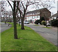
Benhall Avenue towards shops, Cheltenham
From the grass strip in the middle of Benhall Avenue. The nearest shop is a One Stop convenience store. http://www.geograph.org.uk/photo/4893121
Image: © Jaggery
Taken: 3 Apr 2016
0.05 miles
3
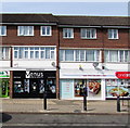
Venus in Benhall, Cheltenham
Hair and beauty salon at 33 Benhall Avenue, next door to a One Stop. http://www.geograph.org.uk/photo/4893121
Image: © Jaggery
Taken: 3 Apr 2016
0.06 miles
4
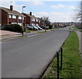
Bibury Road, Cheltenham
The right turn ahead is into Robert Burns Avenue.
Image: © Jaggery
Taken: 3 Apr 2016
0.06 miles
5
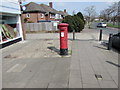
Queen Elizabeth II pillarbox, Benhall Avenue, Cheltenham
On the right here. http://www.geograph.org.uk/photo/4893121
Image: © Jaggery
Taken: 3 Apr 2016
0.06 miles
6
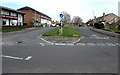
Junction at the southern end of Benhall Avenue, Cheltenham
Extending southwards for 350 metres from the A40 Gloucester Road,
Benhall Avenue ends here at the Bibury Road junction.
The National Hunt pub http://www.geograph.org.uk/photo/4893201 is on the left.
Image: © Jaggery
Taken: 3 Apr 2016
0.06 miles
7
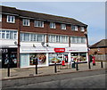
One Stop convenience store, Benhall Avenue, Cheltenham
Viewed in early April 2016. An August 2012 Google Earth Street View shows a Co-operative Food store here.
Image: © Jaggery
Taken: 3 Apr 2016
0.06 miles
8
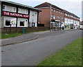
Pub and shops at the southern end of Benhall Avenue, Cheltenham
The National Hunt pub http://www.geograph.org.uk/photo/4893201 is on the left.
Image: © Jaggery
Taken: 3 Apr 2016
0.06 miles
9
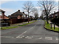
Farmington Road, Cheltenham
Viewed across Benhall Avenue.
Image: © Jaggery
Taken: 3 Apr 2016
0.06 miles
10
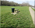
Litter bin and backless bench, Bibury Road, Cheltenham
On the south side of Bibury Road, at the top of the grassy bank above Hatherley Brook.
Image: © Jaggery
Taken: 3 Apr 2016
0.06 miles