
IMAGES TAKEN NEAR TO
Stanton Way, CHELTENHAM, GL51 6AW
Introduction
This page details the photographs taken nearby to Stanton Way, GL51 6AW by members of the Geograph project.
The Geograph project started in 2005 with the aim of publishing, organising and preserving representative images for every square kilometre of Great Britain, Ireland and the Isle of Man.

There are currently over 7.5m images from over14,400 individuals and you can help contribute to the project by visiting https://www.geograph.org.uk
Image Map
Images are licensed for reuse under creativecommons.org/licenses/by-sa/2.0
Notes
- Clicking on the map will re-center to the selected point.
- The higher the marker number, the further away the image location is from the centre of the postcode.
Image Listing (84 Images Found)
Images are licensed for reuse under creativecommons.org/licenses/by-sa/2.0
Image
Details
Distance
1
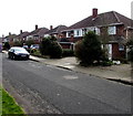
Campden Road houses, Cheltenham
The houses face trees and hedges on the south side of the A40 Gloucester Road.
Image: © Jaggery
Taken: 3 Apr 2016
0.09 miles
2
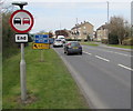
End of the No Overtaking Zone, Gloucester Road, Cheltenham
The sign is on the south side of the A40 Gloucester Road, near a GCHQ direction sign. GCHQ is the UK Government Communications Headquarters which is the centre for Her Majesty's Government's Signal Intelligence (SIGINT) activities.
Image: © Jaggery
Taken: 3 Apr 2016
0.09 miles
3
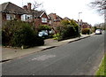
West along Campden Road, Cheltenham
The houses face trees and hedges on the south side of the A40 Gloucester Road.
Image: © Jaggery
Taken: 3 Apr 2016
0.09 miles
4
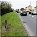
Stone alongside the A40 Gloucester Road, Cheltenham
Perhaps originally a milestone, in April 2016 this is only a stone because any information has been obliterated by many decades of exposure to weathering and pollution.
Image: © Jaggery
Taken: 3 Apr 2016
0.09 miles
5
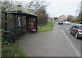
Tennyson Road bus stop and shelter, Cheltenham
On the south side of the A40 Gloucester Road, opposite the Tennyson Road junction. http://www.geograph.org.uk/photo/5026506
This side of the road for buses towards Gloucester.
Image: © Jaggery
Taken: 3 Apr 2016
0.09 miles
6
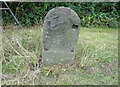
Old Milestone, A40 Cheltenham
On the southern verge of the A40. Between Benhall to the south & St Marks to the north. In 1901 it was at about 163 ft Above Sea level but no benchmark could be found, possibly putting an earliest date on its installation. Plate missing.
Inscription: Cheltenham 2
Milestone Society National ID: GL_CMGL02
Image: © Mr Red
Taken: 21 Sep 2021
0.10 miles
7
Notgrove Close
Road in the suburbs of Cheltenham.
Image: © Wayland Smith
Taken: 17 Apr 2021
0.10 miles
8

Worcester Megabus in Cheltenham
The 3-axle bus is on the A40 Gloucester Road heading towards the centre of Cheltenham.
Its electronic destination display shows Worcester.
Image: © Jaggery
Taken: 3 Apr 2016
0.10 miles
9
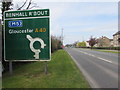
Benhall Roundabout direction sign, Cheltenham
Facing westbound vehicles on the A40 Gloucester Road, 300 metres from the roundabout.
Image: © Jaggery
Taken: 3 Apr 2016
0.10 miles
10
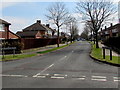
Farmington Road, Cheltenham
Viewed across Benhall Avenue.
Image: © Jaggery
Taken: 3 Apr 2016
0.11 miles