
IMAGES TAKEN NEAR TO
Mitre Gardens, CHELTENHAM, GL51 4UN
Introduction
This page details the photographs taken nearby to Mitre Gardens, GL51 4UN by members of the Geograph project.
The Geograph project started in 2005 with the aim of publishing, organising and preserving representative images for every square kilometre of Great Britain, Ireland and the Isle of Man.

There are currently over 7.5m images from over14,400 individuals and you can help contribute to the project by visiting https://www.geograph.org.uk
Image Map
Images are licensed for reuse under creativecommons.org/licenses/by-sa/2.0
Notes
- Clicking on the map will re-center to the selected point.
- The higher the marker number, the further away the image location is from the centre of the postcode.
Image Listing (85 Images Found)
Images are licensed for reuse under creativecommons.org/licenses/by-sa/2.0
Image
Details
Distance
1
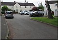
Dead-end part of Bishop Road, Shurdington
On the east side of the through part of Bishop Road.
Image: © Jaggery
Taken: 23 Jun 2019
0.03 miles
2

Lawn Crescent, Shurdington
Cul-de-sac on the southwest side of Church Lane.
Image: © Jaggery
Taken: 23 Jun 2019
0.03 miles
3

Sobey Suite entrance, Shurdington Community Centre
The entrance is between the two buildings here. https://www.geograph.org.uk/photo/6190107
The Link Room was renamed the Sobey Suite in May 2019.
Image: © Jaggery
Taken: 23 Jun 2019
0.04 miles
4
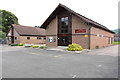
Shurdington Community Centre
Shurdington Community Centre is two buildings which are joined out of shot. The name on the wall on the right is SHURDINGTON COMMUNITY CENTRE. The name over nearby doors is CENTURY HALL. In June 2019, the left side of the Community Centre is used by Shurdington Scouts and Shurdington Pre-School.
Image: © Jaggery
Taken: 23 Jun 2019
0.04 miles
5
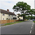
Dominant roadside tree in Shurdington
Alongside and above Bishop Road.
Image: © Jaggery
Taken: 23 Jun 2019
0.04 miles
6
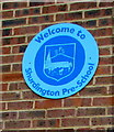
Welcome to Shurdington Pre-School
On the wall here. https://www.geograph.org.uk/photo/6190137
Image: © Jaggery
Taken: 23 Jun 2019
0.05 miles
7

15th Cheltenham (Shurdington) Scouts name sign
The sign on the wall here https://www.geograph.org.uk/photo/6190137 shows that the scout group is twinned with 88-Uroczysko, Szczecin, Poland.
Image: © Jaggery
Taken: 23 Jun 2019
0.05 miles
8

Northeast side of Shurdington Community Centre
On the left here. https://www.geograph.org.uk/photo/6190107
Image: © Jaggery
Taken: 23 Jun 2019
0.05 miles
9
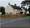
Houses and wooden fencing, Shurdington
Viewed across Bishop Road.
Image: © Jaggery
Taken: 23 Jun 2019
0.05 miles
10

Shurdington Pre-School banner
On railings on the left here. https://www.geograph.org.uk/photo/6190137
Image: © Jaggery
Taken: 23 Jun 2019
0.05 miles