
IMAGES TAKEN NEAR TO
Greenway Lane, CHELTENHAM, GL51 4UF
Introduction
This page details the photographs taken nearby to Greenway Lane, GL51 4UF by members of the Geograph project.
The Geograph project started in 2005 with the aim of publishing, organising and preserving representative images for every square kilometre of Great Britain, Ireland and the Isle of Man.

There are currently over 7.5m images from over14,400 individuals and you can help contribute to the project by visiting https://www.geograph.org.uk
Image Map
Images are licensed for reuse under creativecommons.org/licenses/by-sa/2.0
Notes
- Clicking on the map will re-center to the selected point.
- The higher the marker number, the further away the image location is from the centre of the postcode.
Image Listing (12 Images Found)
Images are licensed for reuse under creativecommons.org/licenses/by-sa/2.0
Image
Details
Distance
1
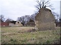
Cotswold Stone Ruin, Greenway, Shurdington
The end walls of high status buildings with dressed corner stones. Just by the Greenway old road which goes from Shurdington up the scarp slope of the Cotswolds. Taken from the footpath to Little Shurdington looking north westwards.
Image: © Bob Embleton
Taken: 11 Mar 2006
0.04 miles
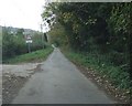
3
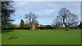
Some specimen trees
Looking north from the kissing gate in Image
These trees are in the park-like grounds of the Greenway Hotel (see; http://www.thegreenwayhotelandspa.com/ ) seen here and accessed from Greenway Lane.
Image: © Jonathan Billinger
Taken: 30 Jan 2016
0.07 miles
4
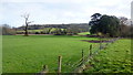
Dead tree in semi-parkland
Looking east towards the Cotswolds scarp from the kissing gate in Image
Image: © Jonathan Billinger
Taken: 30 Jan 2016
0.11 miles
5
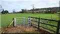
New kissing gate
Footpath linking Whitelands Lane with Greenway Lane.
Image: © Jonathan Billinger
Taken: 30 Jan 2016
0.11 miles
6
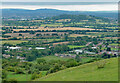
View from Shurdington Hill (2)
Looking west, Shurdington to the right and Churchdown Hill in the distance.
Image: © Stephen Richards
Taken: 21 Aug 2015
0.12 miles
7
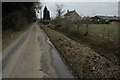
Greenway Lane, Shurdington
Greenway Lane passing Cowley farm in Shurdington. The lane climbs Shurdington Hill but is passable for vehicles for just the first few hundred metres
Image: © Philip Halling
Taken: 29 Jan 2011
0.12 miles
8
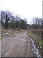
Greenway, Shurdington
This old road runs from Shurdington up the scarp slope of the Cotswolds. It is used by fly tippers as a dumping ground despite warning notices stating one could be fined £20,000 and that the area was under surveillance. Looking easterly towards the cotswold escarpment.
Image: © Bob Embleton
Taken: 11 Mar 2006
0.16 miles
9
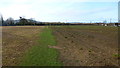
Footpath to Whitelands Lane
To the right is a newly-planted crop of Nordmann Fir Christmas trees and, judging by the weed-kill, the left hand side will soon be planted too.
It would be interesting to walk this path in five years to see the difference.
Image: © Jonathan Billinger
Taken: 30 Jan 2016
0.17 miles
10
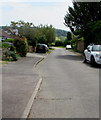
Farm Lane, Shurdington
Farm Lane out of shot ahead follows a route which joins the A46
175 metres from the A46 junction 80 metres behind the camera.
Image: © Jaggery
Taken: 23 Jun 2019
0.21 miles