
IMAGES TAKEN NEAR TO
Redthorne Way, CHELTENHAM, GL51 3NW
Introduction
This page details the photographs taken nearby to Redthorne Way, GL51 3NW by members of the Geograph project.
The Geograph project started in 2005 with the aim of publishing, organising and preserving representative images for every square kilometre of Great Britain, Ireland and the Isle of Man.

There are currently over 7.5m images from over14,400 individuals and you can help contribute to the project by visiting https://www.geograph.org.uk
Image Map
Images are licensed for reuse under creativecommons.org/licenses/by-sa/2.0
Notes
- Clicking on the map will re-center to the selected point.
- The higher the marker number, the further away the image location is from the centre of the postcode.
Image Listing (19 Images Found)
Images are licensed for reuse under creativecommons.org/licenses/by-sa/2.0
Image
Details
Distance
1
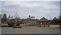
Greatfield Park Primary School
A modern school located in Hulbert Crescent, Up Hatherley. The school has a roll of approximately 200 pupils aged 4 - 11.
Image: © Richard Dorrell
Taken: 3 Mar 2013
0.10 miles
4
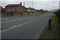
Up Hatherley Way
The Up Hatherley Way bypasses a housing estate on the southern edge of Cheltenham.
Image: © Philip Halling
Taken: 29 Jan 2011
0.12 miles
5
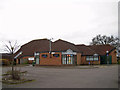
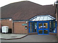
Library, Up Hatherley
Located at the end of Hulbert Crescent. The building also houses a Community Hall.
Image: © Richard Dorrell
Taken: 3 Mar 2013
0.12 miles
6
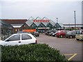
Safeway Supermarket
This Safeway is on the Hatherley Road, on the edge of Warden Hill. It is in the process of being converted to a Morrisons. Circulation is anticlockwise.
Image: © Stephen Bowden
Taken: 23 Apr 2005
0.12 miles
8

Footpath between houses
This path almost certainly follows the route of a track or path that existed long before the modern houses were built. The houses on the right are in Glenlea Grove, and behind the overgrown fence on the left is Greatfield Park Primary School.
Image: © Richard Dorrell
Taken: 3 Mar 2013
0.14 miles
9
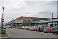
Caernarvon Road shops
A Morrisons Supermarket and a scattering of small shops stand behind their car park off Caernarvon Road, Up Hatherley. Also locally, and built at the same time, are a pub, library and medical centre.
Image: © Richard Dorrell
Taken: 3 Mar 2013
0.14 miles
10
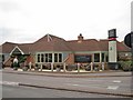
The Greatfield, Up Hatherley
Modern pub and restaurant located not very scenically between Morrison's Supermarket and petrol station off Caernarvon Road, Up Hatherley.
Image: © Richard Dorrell
Taken: 3 Mar 2013
0.15 miles