
IMAGES TAKEN NEAR TO
St. Stephens Road, CHELTENHAM, GL51 3BG
Introduction
This page details the photographs taken nearby to St. Stephens Road, GL51 3BG by members of the Geograph project.
The Geograph project started in 2005 with the aim of publishing, organising and preserving representative images for every square kilometre of Great Britain, Ireland and the Isle of Man.

There are currently over 7.5m images from over14,400 individuals and you can help contribute to the project by visiting https://www.geograph.org.uk
Image Map
Images are licensed for reuse under creativecommons.org/licenses/by-sa/2.0
Notes
- Clicking on the map will re-center to the selected point.
- The higher the marker number, the further away the image location is from the centre of the postcode.
Image Listing (101 Images Found)
Images are licensed for reuse under creativecommons.org/licenses/by-sa/2.0
Image
Details
Distance
1

St Stephen's Road, Cheltenham
Row of three-storey housing on the south side of Andover Road.
Image: © Jaggery
Taken: 15 Apr 2016
0.05 miles
2
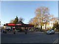
Texaco filling station, Lansdown Road, Cheltenham
Image: © David Smith
Taken: 25 Nov 2016
0.05 miles
3
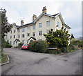
Polefield Gardens, Cheltenham
Cul-de-sac on the southeast side of Hatherley Road.
Image: © Jaggery
Taken: 15 Apr 2016
0.05 miles
4
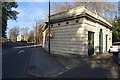
Electricity Substation on Westal Green
I have driven by this building many times, wondering what it is or was. Is it a closed public convenience, or is it part of a larger long gone house. It's much more prosaic, nothing that grand, it's a purpose built electricity Substation.
Image: © Philip Halling
Taken: 20 Nov 2018
0.06 miles
5
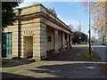
Electricity Substation on Westal Green
I have driven by this building on the A40 many times, wondering what it is or was. Is it a closed public convenience, or is it part of a larger long gone house. It's much more prosaic, nothing that grand, it's a purpose built electricity Substation.
Image: © Philip Halling
Taken: 20 Nov 2018
0.06 miles
6
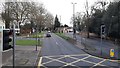
The Lansdown split
Here the A40 splits into two routes, left taking the traffic to the town centre, right avoiding the town centre.
Image: © Jonathan Billinger
Taken: 11 Jan 2020
0.06 miles
7
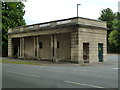
Substation - Cheltenham
This neoclassical building in Cheltenham is actually an electricity substation dating from 1929 and intended to blend into the surrounding architecture.
Image: © Chris Allen
Taken: 7 Jul 2014
0.06 miles
8
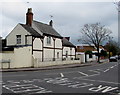
Andover Road, Cheltenham
This western end of Andover Road is part of the A40.
The eastern part of Andover Road is unclassified.
Image: © Jaggery
Taken: 15 Apr 2016
0.07 miles
9
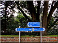
Cycle route directions, Lansdown Road, Cheltenham
On the south side of Lansdown Road, near the Hatherley Road junction.
Image: © Jaggery
Taken: 15 Apr 2016
0.07 miles
10
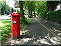
Dual use path beside Lansdown Road, Cheltenham
Showing position of Postbox No. GL50 7.
See Image] for postbox.
Image: © JThomas
Taken: 11 Jul 2019
0.07 miles