IMAGES TAKEN NEAR TO
Kingsmead Road, CHELTENHAM, GL51 0AL
Introduction
This page details the photographs taken nearby to Kingsmead Road, GL51 0AL by members of the Geograph project.
The Geograph project started in 2005 with the aim of publishing, organising and preserving representative images for every square kilometre of Great Britain, Ireland and the Isle of Man.

There are currently over 7.5m images from over14,400 individuals and you can help contribute to the project by visiting https://www.geograph.org.uk
Image Map (Loading...)


Getting Data...Please wait
Leaflet Map data © OpenStreetMap
Images are licensed for reuse under creativecommons.org/licenses/by-sa/2.0
Notes
- Clicking on the map will re-center to the selected point.
- The higher the marker number, the further away the image location is from the centre of the postcode.
Image Listing (22 Images Found)
Images are licensed for reuse under creativecommons.org/licenses/by-sa/2.0
Image
Details
Distance
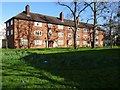
1
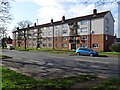
Ceylon House
Ceylon House on Princess Elizabeth Way in Cheltenham. This road was a post-war development and there are a number of apartment blocks such as this named after members of the then British Empire.
Image: © Philip Halling
Taken: 13 Mar 2020
0.11 miles
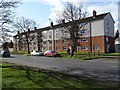
2
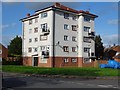
Apartments on Arle Road
Apartment block on Arle Road in Cheltenham.
Image: © Philip Halling
Taken: 13 Mar 2020
0.14 miles
3
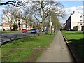
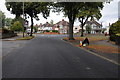
Princess Elizabeth Way
Princess Elizabeth Way a post-war housing development in Cheltenham.
Image: © Philip Halling
Taken: 13 Mar 2020
0.15 miles
4
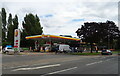
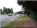
Service station on Princess Elizabeth Way (A4013), Cheltenham
Image: © JThomas
Taken: 9 Aug 2021
0.15 miles
7
Lygon Walk
Apartment block on Lygon Walk, off Princess Elizabeth Way, a post-war housing development.
Image: © Philip Halling
Taken: 13 Mar 2020
0.19 miles
8
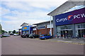
Retail units at Kingsditch
These are across the road from Kingsditch Retail Park but contribute to a huge retail area on the northern side of Cheltenham.
Image: © Bill Boaden
Taken: 16 Jul 2016
0.20 miles
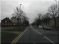
9
Brooklyn Road
Junction of Brooklyn Road with Grevil Road in Arle in Cheltenham.
Image: © Philip Halling
Taken: 13 Aug 2011
0.20 miles
10
Rhodesia House
Rhodesia House on Princess Elizabeth Way in Cheltenham. This road was a post-war development and there are a number of apartment blocks such as this named after members of the then British Empire.
Image: © Philip Halling
Taken: 13 Mar 2020
0.20 miles