IMAGES TAKEN NEAR TO
Roman Hackle Avenue, CHELTENHAM, GL50 4ST
Introduction
This page details the photographs taken nearby to Roman Hackle Avenue, GL50 4ST by members of the Geograph project.
The Geograph project started in 2005 with the aim of publishing, organising and preserving representative images for every square kilometre of Great Britain, Ireland and the Isle of Man.

There are currently over 7.5m images from over14,400 individuals and you can help contribute to the project by visiting https://www.geograph.org.uk
Image Map (Loading...)


Getting Data...Please wait
Leaflet Map data © OpenStreetMap
Images are licensed for reuse under creativecommons.org/licenses/by-sa/2.0
Notes
- Clicking on the map will re-center to the selected point.
- The higher the marker number, the further away the image location is from the centre of the postcode.
Image Listing (14 Images Found)
Images are licensed for reuse under creativecommons.org/licenses/by-sa/2.0
Image
Details
Distance
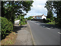
1
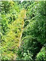
View south, disused railway trackbed, Swindon Village, Cheltenham
This is a view of the trackbed of what was once the Great Western Railway line from Cheltenham, station, about 2.5 kilometres away in the direction of view, to Stratford upon Avon via Honeybourne. The line closed as recently as 1976.
Image: © Brian Robert Marshall
Taken: 1 Aug 2014
0.06 miles
3
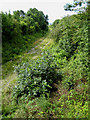
Trackbed of former railway
This is part of the former GW line between Cheltenham and Bishop's Cleeve. Looking towards Cheltenham from the bridge on Swindon Lane.
Image: © Pauline E
Taken: 12 Jul 2008
0.12 miles
4
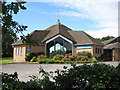
St Nicolas' Church, Swindon Lane
Wymans Brook area of Cheltenham. The church hall is to the right.
Image: © Pauline E
Taken: 12 Jul 2008
0.14 miles
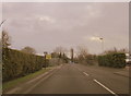
5
Swindon Lane crosses former railway line
The road narrows at this point as it crosses the former GW line between Cheltenham and Bishop's Cleeve. A concrete footbridge has been constructed - seen here on the left.
Image: © Pauline E
Taken: 12 Jul 2008
0.18 miles
6
Swindon Lane Cheltenham Crossing Dismantled Railway
Image: © Roy Hughes
Taken: 22 Dec 2014
0.18 miles
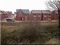
7
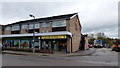
Wyman's Brook Pharmacy
A suburb on the northern side of Cheltenham.
Image: © Jonathan Billinger
Taken: 1 Nov 2012
0.22 miles
9
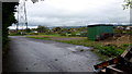
Midwinter allotments, St. Peter's
Pictured from the main entrance; the title is the name of the place not the time of year (quite).
Image: © Jonathan Billinger
Taken: 1 Nov 2012
0.23 miles
10
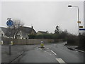
Tommy Taylor's Lane mini roundabout
Taken from Swindon Lane.
Image: © Peter Whatley
Taken: 29 Jan 2013
0.24 miles