
IMAGES TAKEN NEAR TO
Park Place, CHELTENHAM, GL50 2RA
Introduction
This page details the photographs taken nearby to Park Place, GL50 2RA by members of the Geograph project.
The Geograph project started in 2005 with the aim of publishing, organising and preserving representative images for every square kilometre of Great Britain, Ireland and the Isle of Man.

There are currently over 7.5m images from over14,400 individuals and you can help contribute to the project by visiting https://www.geograph.org.uk
Image Map
Images are licensed for reuse under creativecommons.org/licenses/by-sa/2.0
Notes
- Clicking on the map will re-center to the selected point.
- The higher the marker number, the further away the image location is from the centre of the postcode.
Image Listing (75 Images Found)
Images are licensed for reuse under creativecommons.org/licenses/by-sa/2.0
Image
Details
Distance
1
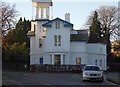
House on The Park
The Park is an almost circular road in the south of Cheltenham. Inside the circle is almost totally occupied by the Park Campus of the University of Gloucestershire with just a few houses, this being one of them.
Image: © Terry Jacombs
Taken: 9 Jan 2009
0.09 miles
2
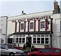
The Jolly Brewmaster, Painswick Road, Cheltenham
Set in the middle of a number of residential streets, the pub is a popular venue.
Image: © Terry Jacombs
Taken: 24 Jan 2009
0.09 miles
3
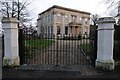
Brandon House
Brandon House on the corner of Painswick Road and Grafton Road in Leckhampton, Cheltenham. The house was built for Henry Norwood Tyre, around 1834-39, the architect was probably John Forbes. The building is Grade II* listed https://historicengland.org.uk/listing/the-list/list-entry/1387401?section=official-list-entry, and today the building is a commercial office.
Image: © Philip Halling
Taken: 23 Dec 2015
0.10 miles
4
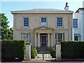
18 Park Place, Cheltenham
A crisp refined villa built c1830. Ionic porch and some incised detail after John Soane. Grade II listed.
Image: © Stephen Richards
Taken: 21 May 2015
0.11 miles
5
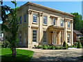
Brandon House, Painswick Road, Cheltenham
A very fine villa built c1835 for H.N. Tyre, possibly to the designs of John Forbes. The paired columns to the porch have capitals derived from the Tower of the Winds. Grade II* listed.
Now converted to offices.
Image: © Stephen Richards
Taken: 21 May 2015
0.11 miles
6
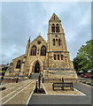
St. Philip and St. James, Leckhampton
Viewed from the newly-landscaped car park off Grafton Road.
Image: © Jonathan Billinger
Taken: 19 Sep 2023
0.11 miles
7
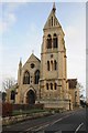
St Philip's and St James' church
St Philip's and St James' church on Grafton Road in Cheltenham is a Victorian church built in a gothic style.
Image: © Philip Halling
Taken: 23 Dec 2015
0.11 miles
8
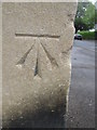
Ordnance Survey Cut Mark
This OS cut mark can be found on the SW angle of the Church of St Philip & St James. It marks a point 68.6318m above mean sea level.
Image: © Adrian Dust
Taken: 28 Jun 2015
0.11 miles
9
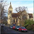
St Philip and St James', Painswick Road, Cheltenham
The church was consecrated in 1840 to cater for the growing population south of Cheltenham who had previously been served by St Peters Church, Leckhampton. Being surrounded by housing, it is difficult to get a good vantage point for a photograph.
Image: © Terry Jacombs
Taken: 20 Jan 2009
0.11 miles
10
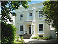
Clarendon, The Park, Cheltenham
The pick of the estate's early villas. It was built c1830. Grade II listed.
Image: © Stephen Richards
Taken: 21 May 2015
0.11 miles