
IMAGES TAKEN NEAR TO
Painswick Road, CHELTENHAM, GL50 2EY
Introduction
This page details the photographs taken nearby to Painswick Road, GL50 2EY by members of the Geograph project.
The Geograph project started in 2005 with the aim of publishing, organising and preserving representative images for every square kilometre of Great Britain, Ireland and the Isle of Man.

There are currently over 7.5m images from over14,400 individuals and you can help contribute to the project by visiting https://www.geograph.org.uk
Image Map
Images are licensed for reuse under creativecommons.org/licenses/by-sa/2.0
Notes
- Clicking on the map will re-center to the selected point.
- The higher the marker number, the further away the image location is from the centre of the postcode.
Image Listing (38 Images Found)
Images are licensed for reuse under creativecommons.org/licenses/by-sa/2.0
Image
Details
Distance
1
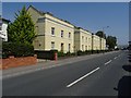
Houses on Shurdington Road
Modern houses on the A46 Shurdington Road in Cheltenham. Curiously named Regency Square.
Image: © Philip Halling
Taken: 12 Aug 2020
0.04 miles
2
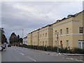
Houses in Shurdington Road, A46, Cheltenham
A modern terrace of houses on the main road south-west of Cheltenham
Image: © David Smith
Taken: 29 Dec 2017
0.07 miles
4
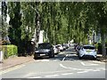
Cars parked on Gratton Road
Cars park on the tree-lined leafy Gratton Road off Shurdington Road.
Image: © Philip Halling
Taken: 12 Aug 2020
0.11 miles
5
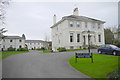
Pavilion Gardens
This private road on the south east side of The Park is very close to the University and overlooks open space.
Image: © Nigel Mykura
Taken: 10 Dec 2015
0.12 miles
6
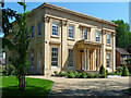
Brandon House, Painswick Road, Cheltenham
A very fine villa built c1835 for H.N. Tyre, possibly to the designs of John Forbes. The paired columns to the porch have capitals derived from the Tower of the Winds. Grade II* listed.
Now converted to offices.
Image: © Stephen Richards
Taken: 21 May 2015
0.12 miles
7
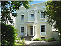
Clarendon, The Park, Cheltenham
The pick of the estate's early villas. It was built c1830. Grade II listed.
Image: © Stephen Richards
Taken: 21 May 2015
0.13 miles
8
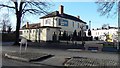
The Norwood Arms
The pub sits in the fork between the Shurdington and Bath Roads leaving Cheltenham to the south
Image: © Terry Jacombs
Taken: 18 Jan 2009
0.13 miles
9
Brandon House
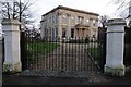
Brandon House on the corner of Painswick Road and Grafton Road in Leckhampton, Cheltenham. The house was built for Henry Norwood Tyre, around 1834-39, the architect was probably John Forbes. The building is Grade II* listed https://historicengland.org.uk/listing/the-list/list-entry/1387401?section=official-list-entry, and today the building is a commercial office.
Image: © Philip Halling
Taken: 23 Dec 2015
0.13 miles
10
Edward Street, Cheltenham
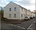
Houses on the east side of the street, viewed from Grafton Road.
Image: © Jaggery
Taken: 25 Nov 2011
0.13 miles