
IMAGES TAKEN NEAR TO
Cranham, GLOUCESTER, GL4 8HZ
Introduction
This page details the photographs taken nearby to GL4 8HZ by members of the Geograph project.
The Geograph project started in 2005 with the aim of publishing, organising and preserving representative images for every square kilometre of Great Britain, Ireland and the Isle of Man.

There are currently over 7.5m images from over14,400 individuals and you can help contribute to the project by visiting https://www.geograph.org.uk
Image Map
Images are licensed for reuse under creativecommons.org/licenses/by-sa/2.0
Notes
- Clicking on the map will re-center to the selected point.
- The higher the marker number, the further away the image location is from the centre of the postcode.
Image Listing (29 Images Found)
Images are licensed for reuse under creativecommons.org/licenses/by-sa/2.0
Image
Details
Distance
1
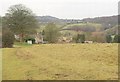
Approaching Cranham
Footpath MCR/42/1 descends Cranham Common to the edge of the western part of the village. Behind is the upper valley of the Painswick Stream.
Image: © Derek Harper
Taken: 31 Dec 2010
0.05 miles
2
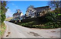
Cranham Church of England Primary School, Cranham
Image: © P L Chadwick
Taken: 6 Mar 2011
0.06 miles
3
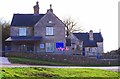
Cranham Church of England Primary School, Cranham
The school caters for pupils aged 4 to 11 and has about 60 children on its roll.
Image
Image: © P L Chadwick
Taken: 6 Mar 2011
0.06 miles
4
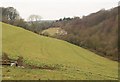
Brook Farm
A view down the steep valley shown in Image from footpath MCR/42/1. The drinking trough on the left appears in both images.
Image: © Derek Harper
Taken: 31 Dec 2010
0.12 miles
5
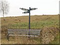
Signpost, Cranham
This smart signpost on Cranham Common shows how the village is divided. The church and school lie to the west; the Black Horse, village hall and scout HQ to the northeast; the common is in between.
Image: © Derek Harper
Taken: 31 Dec 2010
0.12 miles
6
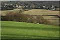
Cranham
The village of Cranham and the village church of St James viewed from the north-east.
Image: © Philip Halling
Taken: 26 Jan 2008
0.14 miles
7
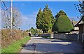
Lane by Church of St. James the Great, Cranham
The village of Cranham is rather spread out. In this direction lie the school and the village pub.
Image: © P L Chadwick
Taken: 6 Mar 2011
0.16 miles
8
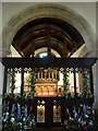
Cranham Church
The rood and rood screen, chancel and altar. St. James the Great is a Grade II listed church that dates back to Norman times. Gustav Holst lived in Cranham for a while and his mother played the organ in the church.
Image: © pam fray
Taken: 14 Sep 2016
0.16 miles
9

Chest tomb, Cranham churchyard
The tomb, to William Newarke, who died in 1641, has a decoration of lozenges http://www.britishlistedbuildings.co.uk/en-132705-newarke-monument-in-the-churchyard-appro .
Image: © Derek Harper
Taken: 31 Dec 2010
0.17 miles
10
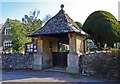
Church of St. James the Great (6) - lychgate, Cranham
The lychgate was constructed in memory of those who served in World War I (1914-1918). It contains a list of the men from the parish who fought in both World Wars. The bell hanging there is from HMS Cranham, a former minesweeper named after the village, and was presented to the church in 1967.
Other photos:- Image
Image: © P L Chadwick
Taken: 6 Mar 2011
0.17 miles