
IMAGES TAKEN NEAR TO
Bondend Road, GLOUCESTER, GL4 8DZ
Introduction
This page details the photographs taken nearby to Bondend Road, GL4 8DZ by members of the Geograph project.
The Geograph project started in 2005 with the aim of publishing, organising and preserving representative images for every square kilometre of Great Britain, Ireland and the Isle of Man.

There are currently over 7.5m images from over14,400 individuals and you can help contribute to the project by visiting https://www.geograph.org.uk
Image Map
Images are licensed for reuse under creativecommons.org/licenses/by-sa/2.0
Notes
- Clicking on the map will re-center to the selected point.
- The higher the marker number, the further away the image location is from the centre of the postcode.
Image Listing (12 Images Found)
Images are licensed for reuse under creativecommons.org/licenses/by-sa/2.0
Image
Details
Distance
2
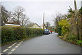
Bondend Rd
This is the junction of Bondend Lane and Nuthill , the road on the left, which unsurprisingly leads to the prominent local hill of Nuthill.
Image: © Nigel Mykura
Taken: 11 Dec 2015
0.07 miles
5
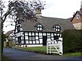
Bondend Farm
Grade II listed farmhouse dating from the 16th century
Image: © Graham Hogg
Taken: 25 Apr 2016
0.20 miles
6
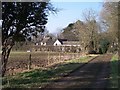
Old Road from Manor Farm to Bondend
Looking north along the lane.
Image: © Bob Embleton
Taken: 15 Mar 2006
0.20 miles
7
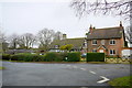
Houses at Bondend
The half timbered black and white cottage appears quite old. It is on the access road leading to Bowden Hall which is now a hotel
Image: © Nigel Mykura
Taken: 11 Dec 2015
0.21 miles
8
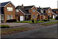
Bondend Road houses, Upton St Leonards
Viewed from the Churchfield Road end.
Image: © Jaggery
Taken: 22 Nov 2013
0.22 miles
9
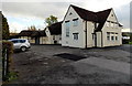
Upton St Leonards Village Hall
Located in Bondend Road, next door to the Birchall Memorial Institute. http://www.geograph.org.uk/photo/3597572
Image: © Jaggery
Taken: 22 Nov 2013
0.22 miles
10
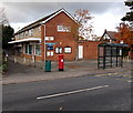
Upton St Leonards Post Office
Viewed across Churchfield Road from the corner of Six Acres. The post office inside the village shop in the background. The shop nearer the camera is The Clothes Press.
Image: © Jaggery
Taken: 22 Nov 2013
0.24 miles