IMAGES TAKEN NEAR TO
Upton Hill, GLOUCESTER, GL4 8DB
Introduction
This page details the photographs taken nearby to Upton Hill, GL4 8DB by members of the Geograph project.
The Geograph project started in 2005 with the aim of publishing, organising and preserving representative images for every square kilometre of Great Britain, Ireland and the Isle of Man.

There are currently over 7.5m images from over14,400 individuals and you can help contribute to the project by visiting https://www.geograph.org.uk
Image Map
Images are licensed for reuse under creativecommons.org/licenses/by-sa/2.0
Notes
- Clicking on the map will re-center to the selected point.
- The higher the marker number, the further away the image location is from the centre of the postcode.
Image Listing (10 Images Found)
Images are licensed for reuse under creativecommons.org/licenses/by-sa/2.0
Image
Details
Distance
1
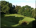
Horses on Upton Hill
Trees surround small fields of odd shapes on the slopes above the M5. This scene is close to the B4073 and the Hatton Court Hotel. A friend has pointed out how the shadow resembles a horse's head painting in Lascaux.
Image: © Derek Harper
Taken: 4 Jul 2008
0.11 miles
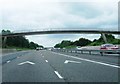
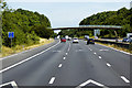
3
Nearing the new services at Gloucester on the M5 south
Image: © Steve Fareham
Taken: 20 Aug 2015
0.22 miles
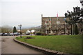
4
View from above Upton St Leonards
View from a bridleway above Upton St Leonards. The hill in the middle distance is Chosen Hill, also known as Churchdown Hill, Bredon Hill can be seen in the background and Tewkesbury Abbey is caught in the sun to the left.
Image: © Philip Halling
Taken: 2 Jan 2011
0.22 miles
6
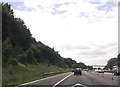
Footbridge over M5 south near Grove Court
Image: © John Firth
Taken: 8 Jun 2014
0.24 miles
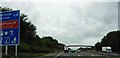
7
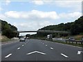
M5 Motorway - footbridge near Sneedham's Green
An unusual structure for this section of the M5 and probably an original structure, judging by the supporting pillars which slightly encroach on the emergency lane's headroom. Concrete blocks have been arranged around them to reduce the chance of collision and consequent bridge collapse.
Image: © J Whatley
Taken: 31 Aug 2010
0.24 miles
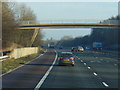
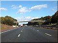
9
Accommodation Bridge over the M5 near Matson
Image: © David Dixon
Taken: 25 Jul 2018
0.24 miles
10
Footbridge over M5 south of Winnycroft Farm
Several paths converge on this bridge. However the 1930's map does not show any paths across this part of the hill.
Image: © David Smith
Taken: 16 Oct 2012
0.25 miles