1
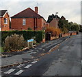
The Lampreys, Gloucester
The Lampreys is a long residential cul-de-sac extending from Painswick Road
on this side to the edge of the A38 Eastern Avenue about 200 metres ahead.
Image: © Jaggery
Taken: 22 Nov 2013
0.05 miles
2
Painswick Road houses, Gloucester
The houses are NW of The Lampreys junction. http://www.geograph.org.uk/photo/3965535
Image: © Jaggery
Taken: 22 Nov 2013
0.11 miles
3
The Meeting Room, Gloucester
Christian Brethren place of worship at 159 Painswick Road.
Image: © Jaggery
Taken: 22 Nov 2013
0.11 miles
4
Morgan Supplies Ltd, Gloucester
Building materials suppliers at 143 Painswick Road.
Image: © Jaggery
Taken: 22 Nov 2013
0.13 miles
5
Askwith Road bungalows, Gloucester
Viewed from the western (Painswick Road) end.
Image: © Jaggery
Taken: 22 Nov 2013
0.13 miles
6
S.P.A. Vets, Gloucester
Located on the corner of Painswick Road and Cotteswold Road, this is S.P.A. Vet Services Ltd's
main surgery. The business has a branch surgery in Quedgeley.
Image: © Jaggery
Taken: 22 Nov 2013
0.14 miles
7
Old Painswick Road, Gloucester
Part of a boomerang-shaped section of the old road to Painswick,
on the east side of the straight course of the B4073 Painswick Road.
Image: © Jaggery
Taken: 22 Nov 2013
0.16 miles
8
St Aldate, Finlay Road, Gloucester
"The first 'modern' church in Gloucester and still the only one of any note". By Robert Potter & Richard Hare, built 1962-64, "on the model of St Agnes, Fontaine-les-Gres in northern France". Structural engineers, E.W.H. Gifford & Partners. Grade II* listed.
Image: © Stephen Richards
Taken: 19 May 2015
0.17 miles
9
Grade II listed thatched cottage, Painswick Road, Gloucester
The timber frame and painted brick cottage with a thatched roof dates from the early 17th century,
with later extensions, alterations and a major restoration in the 20th century. Grade II listed in 1973.
Image: © Jaggery
Taken: 22 Nov 2013
0.18 miles
10
St Aldate church, Gloucester
St Aldate church was designed by Robert Potter and Richard Hare in 1959-61 and was built in 1962-64.
Image: © Philip Halling
Taken: 20 Mar 2010
0.19 miles


